This lake used to be called Rice Lake, but a nearby lake now has that name instead. The lake is on a dead end route. There is a single campsite on this lake. If you want solitude in this part of the BWCA, this lake offers it. The portage into Keneu Lake is somewhat overgrown, probably owing to its lack of use. The majority of paddlers don't visit lakes off the main route.
Keneu Lake drains out to Hook Lake through a small creek visible along the Keneu Lake to Hook Lake portage. This creek forms a pretty little rapids where it flows into Hook Lake when the water levels are high, but in the middle of summer there may be little flow at all. A small creek that drains the area south of Keneu Lake, flows into its southern tip. This creek flows through a muskeg/marshy area.
References:
Pauly, Daniel, Exploring the Boundary Waters (Minneapolis: University of Minnesota Press, 2005), 86.
Click on the photos below to see the full resolution image - Use your browsers back button to close photo and return to this page.
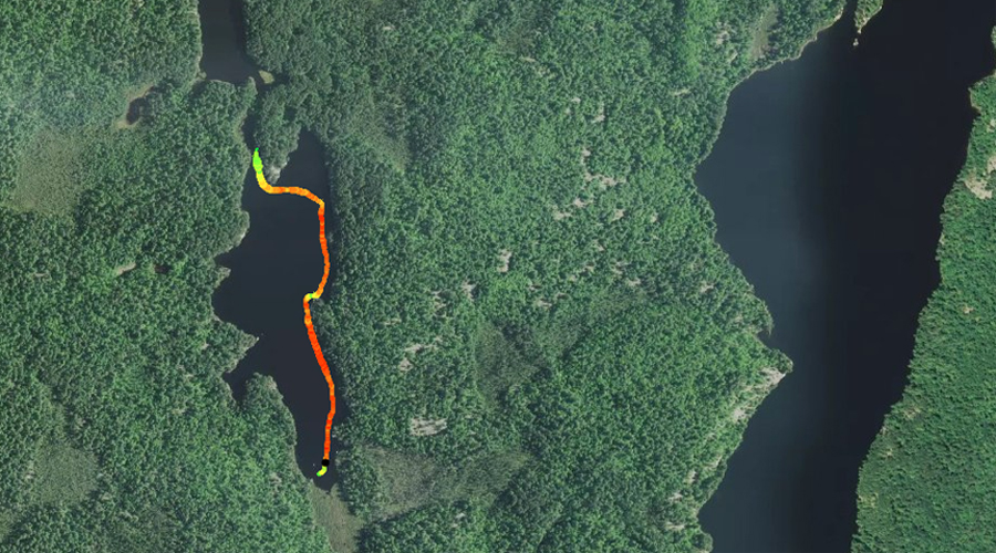
PADDLING FROM HOOK LAKE PORTAGE TO SOUTH END OF KENEU LAKE
A grove of fairly large pines graces the southwest corner of Keneu Lake. The swampy southern end of the lake is visible to the left.
After leaving the Hook Lake portage, paddle southward generally staying along the western side of the lake. The south end of Keneu Lake is speckled with several large boulders sticking out of the water and a marshy shoreline. You pass by the lakes only campsite from a distance, as it is already occupied.
A couple boulders protruding from the south end of Keneu Lake. Looking northeast from here. Explore Another Route ***********************************************END OF ROUTE***********************************************
PADDLING FROM SOUTH END OF KENEU LAKE TO HOOK LAKE PORTAGE
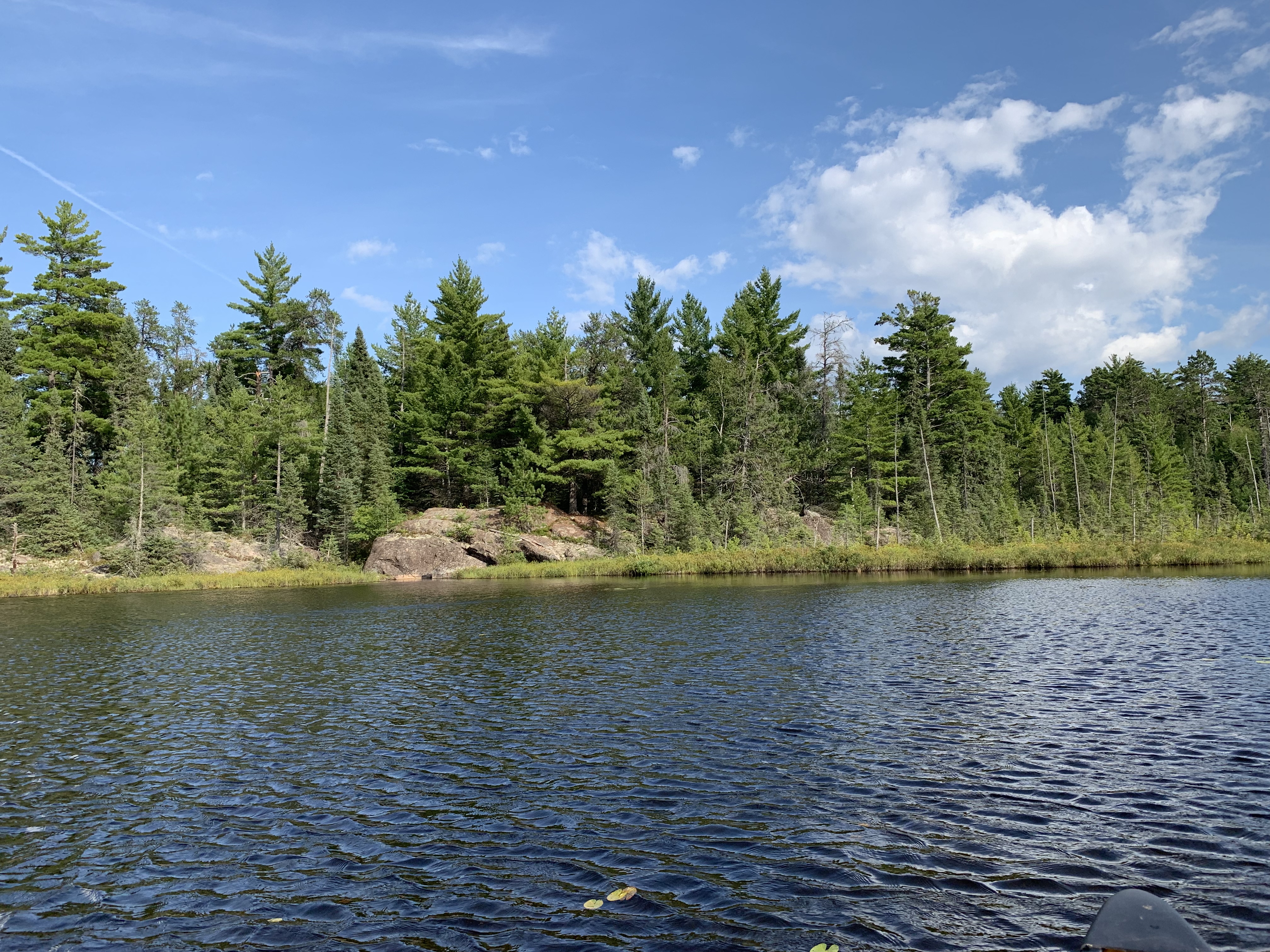
This rock formation is in the southeast corner of the lake. To the right of your view is an area of wetland, which borders much of the south end of the lake.
A relatively short paddle across this small lake staying somewhat close to the eastern shoreline. You are paddling north. You finish up the trip when you reach the portage leading to Hook Lake. The north end of the lake has a prominent rocky point jutting out into the lake.
A view toward the distant north end of Keneu Lake. Your location is just off the south shore of the lake.
The largest rock outcrop on the lake. These rocks form the erosion resistant point that juts down from the north end of the lake. Portage to Hook Lake -or- Explore Another Route ***********************************************END OF ROUTE***********************************************