Tin Can Mike Lake
Kawishiwi Ranger District
TIN CAN MIKE LAKE CAMPSITES:
None visited yet.
Campsite 1: (#2095) - East shoreline
Campsite 2: (#1121) - Center of the west shoreline.
Campsite 3: (#1120) - Northern most site on west shoreline.
The lake is colored a light green. The eastern side of the lake is heavily forested. Forest along with extensive marshy areas line the west side of the lake. The south bay of the lake, where one of the logging era railroad spurs terminated, contains a number of dead heads (old logs still floating in the lake dating to the early 1900's. This railroad was built by the Swallow and Hopkins Company and followed what is now the very flat portage leading to Sandpit Lake (Heinselman, 1999). The railroad continued along the western shoreline of Tin Can Mike Lake and terminated shortly after upon reaching the south shore of Horse Lake.
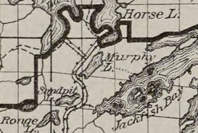
This lake was once known as Murphy Lake (map below was published on April 27, 1927). Murphy Lake was named after Mike Murphy. Legend has it that Mike used a tin can for his coffee cup, so the lake was later renamed Tin Can Mike Lake.
Northern pike are the most abundant fish in this lake, with some walleye. There are three campsites in the north end of the lake. Both portages into the lake are somewhat long, but they are otherwise easy.
This lake drains to the north into Horse Lake via a small creek that flows out from the northwest part of the lake.
References:
Beymer, Robert, Boundary Waters Canoe Area – Volume 1 – Western Region (Berkeley: Wilderness Press, 2006), 146, 168.
Heinselman, Miron, The Boundary Waters Wilderness Ecosystem (Minneapolis: University of Minnesota Press, 1999).
Pauly, Daniel, Exploring the Boundary Waters (Minneapolis: University of Minnesota Press, 2005), 136, 151.
Exploring Tin Can Mike Lake
Click on the photos below to see the full resolution image - Use your browsers back button to close photo and return to this page.
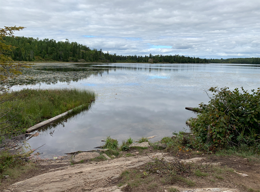
Tin Can Mike Lake as seen from the portage to Sandpit Lake.
Route Connections for Tin Can Mike Lake
From Tin Can Mike Lake, you can portage to Horse Lake or Sandpit Lake.
Return to Top of Page
|


