Fishing: Was skunked fishing. Saw smallmouth bass in rapids where portage to Delta Lake begins. Northern pike in section upstream of Delta Lake
Maps: Fisher F-4, F11, F-31; McKenzie #18, #19
Creek Depth: Over 5 feet in places
Bushwhack Rating: Piece of Cake (for section up to first rapids below Delta Lake); upstream from Delta Lake, "There are worse..."
Creek Distance: About 10 miles from its headwaters at Drumstick Lake to where it drains into Bridge Lake. Passes through two PMA lakes along its course (Quartz Lake and Delta Lake)
This creek begins at Drumstick Lake, a small lake about a mile due north of Starlight Lake which is in the Drag Lake Primitive Management Area. During its roughly 10 mile journey, Drumstick Creek appears to drain Benezie Lake, flows through Quartz Lake and a couple of other unnamed lakes, then passes through Delta Lake and eventually flows into Bridge Lake outside of the PMA. Up to Delta Lake, Drumstick Creek is fairly easy to travel. There will be the occasional beaver dam and plenty of lily pads to plow through. There is an unmaintained portage from Drumstick Creek, uphill to Delta Lake. This trail can still be called a portage rather than a bushwhack. In 2015, there were perhaps a half dozen trees lying over the old portage. Downstream of Delta Lake, Drumstick Creek is outside of the Drag Lake PMA.
Upstream from Delta Lake, the going gets tougher. Between Delta Lake and Quartz Lake, there are at least three sets of rapids that require bushwhacking. There may be a fourth set of rapids that requires another short bushwhack just before Quartz Lake, but didn't get that far on last visit.
Past Quartz Lake, you would no longer follow Drumstick Creek (it turns north) to get to the PMA lakes beyond; those lakes are Blinker Lake and Starlight Lake. Starlight Lake looks particularly enticing. There is a small tributary of Drumstick Creek that leads to those two lakes.
HOW TO GET TO BECOOSIN LAKE AND/OR BENEZIE LAKE:
If you are feeling adventuresome and are confident in traveling through unmarked forest, you can paddle/carry a canoe to Benezie Lake or Becoosin Lake. Following Drumstick Creek is probably the easiest way to do it (and it won't be that easy!). From Delta Lake, continuing paddling up Drumstick Creek until you come to the elongated unnamed lake (first lake upstream of Delta Lake). There is "sort of" a portage path here from the creek into the unnamed lake. The portage path is just to the right of the rapids. Once on the unnamed lake, follow the north shoreline to the notch that makes the northern most tip of the lake (just slightly east of the midway point along the north shoreline). Start your bushwhack to Benezie Lake and/or Becoosin Lake here. It is about 2,000 feet to Becoosin Lake (the easier one to reach) bushwhacking across an old lake bed. At about the halfway point (1,000 feet in), either continue north to Becoosin Lake or turn northeast toward Benezie Lake. If you go for Benezie Lake, you have to bushwhack another 1,000 feet and you will come to a long unnamed lake. Paddle across it and continue northeast from the other end of the lake for another 1,500 feet through the former southwest arm (lake bed) of Benezie Lake. Not an easy adventure, but the only other real way to see these lakes is from the Benezie-Becoosin Loop Trail along the Kekekabic Trail. If anyone is at the trail accessible campsites, they will certainly be surprised to see a canoe out on the lake.
There are smallmouth bass in the rapids and northern pike in the slower moving sections of Drumstick Creek downstream of Delta Lake. There are northern pike in the creek upstream of Delta Lake.
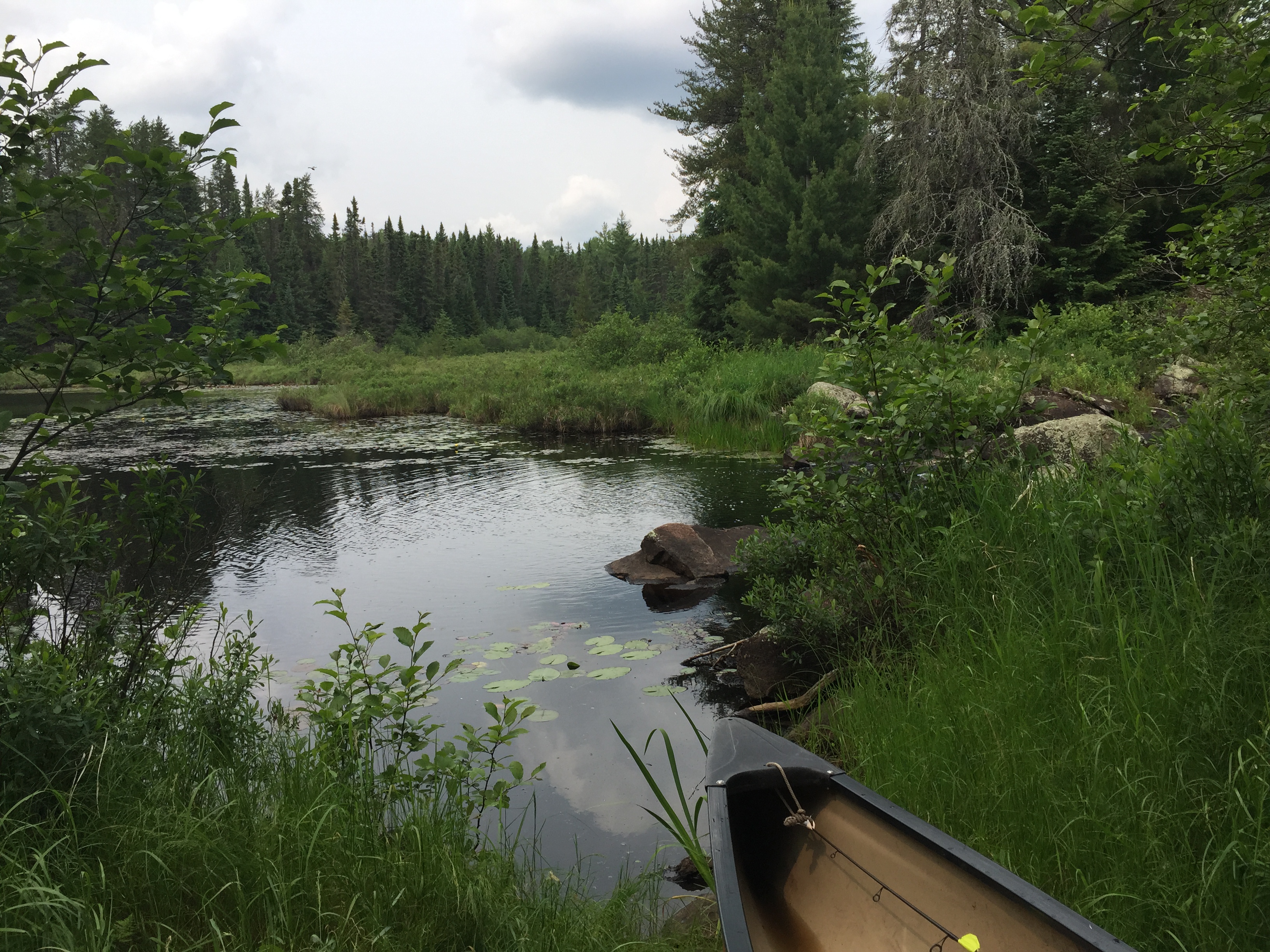
PADDLING FROM BRIDGE LAKE UPSTREAM TO THE DELTA LAKE BUSHWHACK
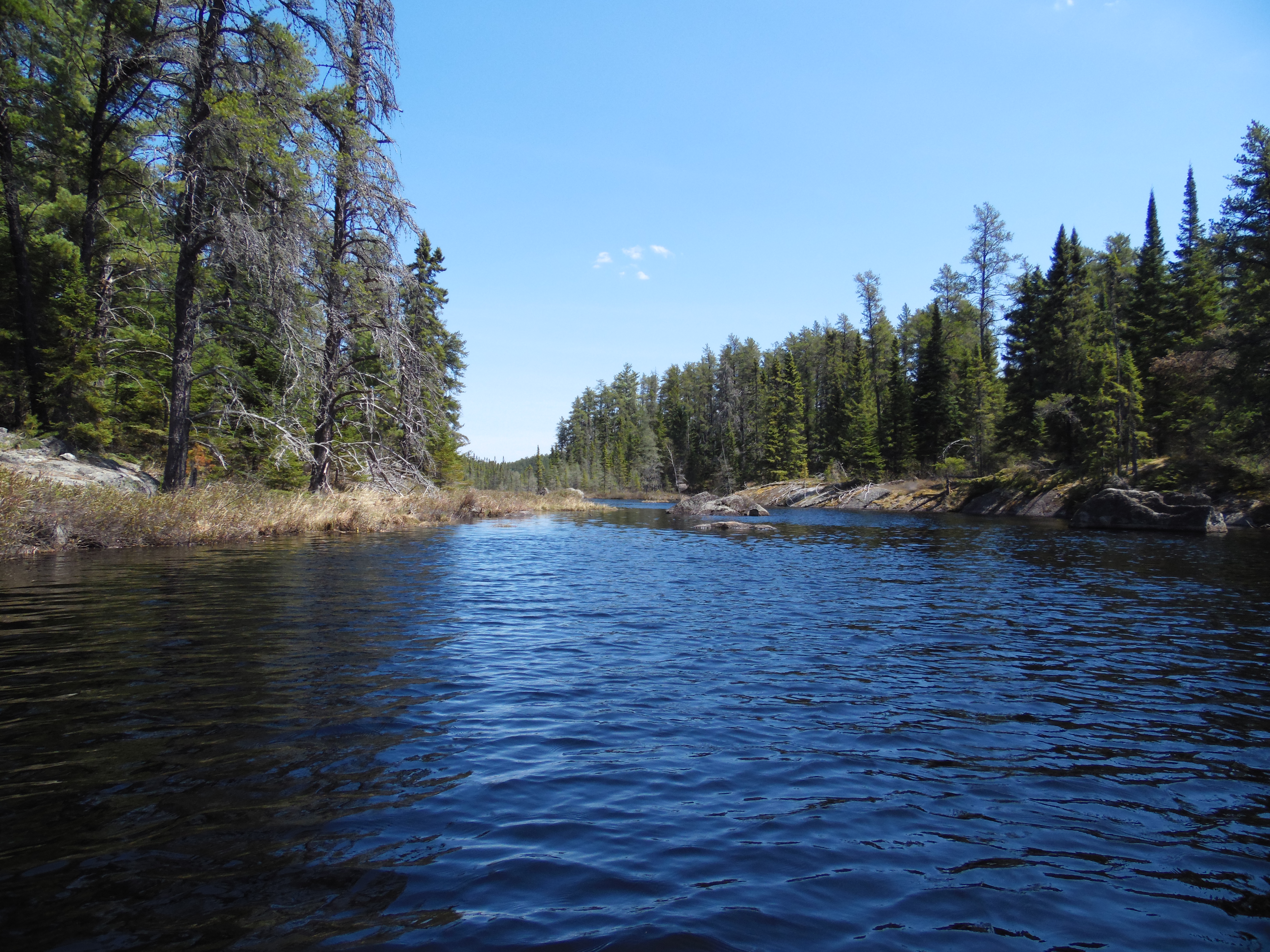
From the mouth of Drumstick Creek, you take a final glance back at Bridge Lake before heading upstream toward Delta Lake.
Drumstick Creek just upstream of Bridge Lake. This is in springtime.
Looking back toward Bridge Lake as you paddle up Drumstick Creek toward Delta Lake.
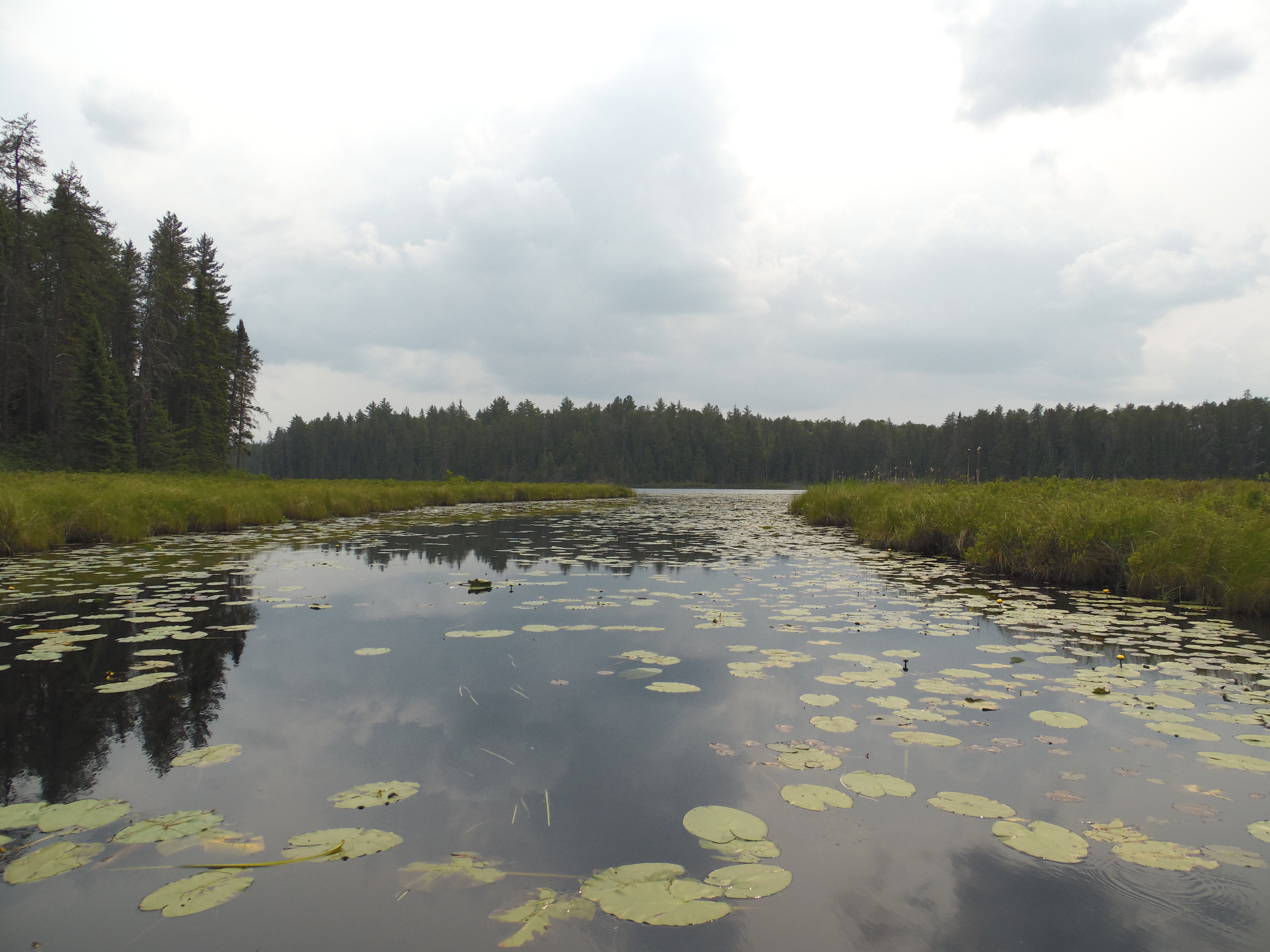
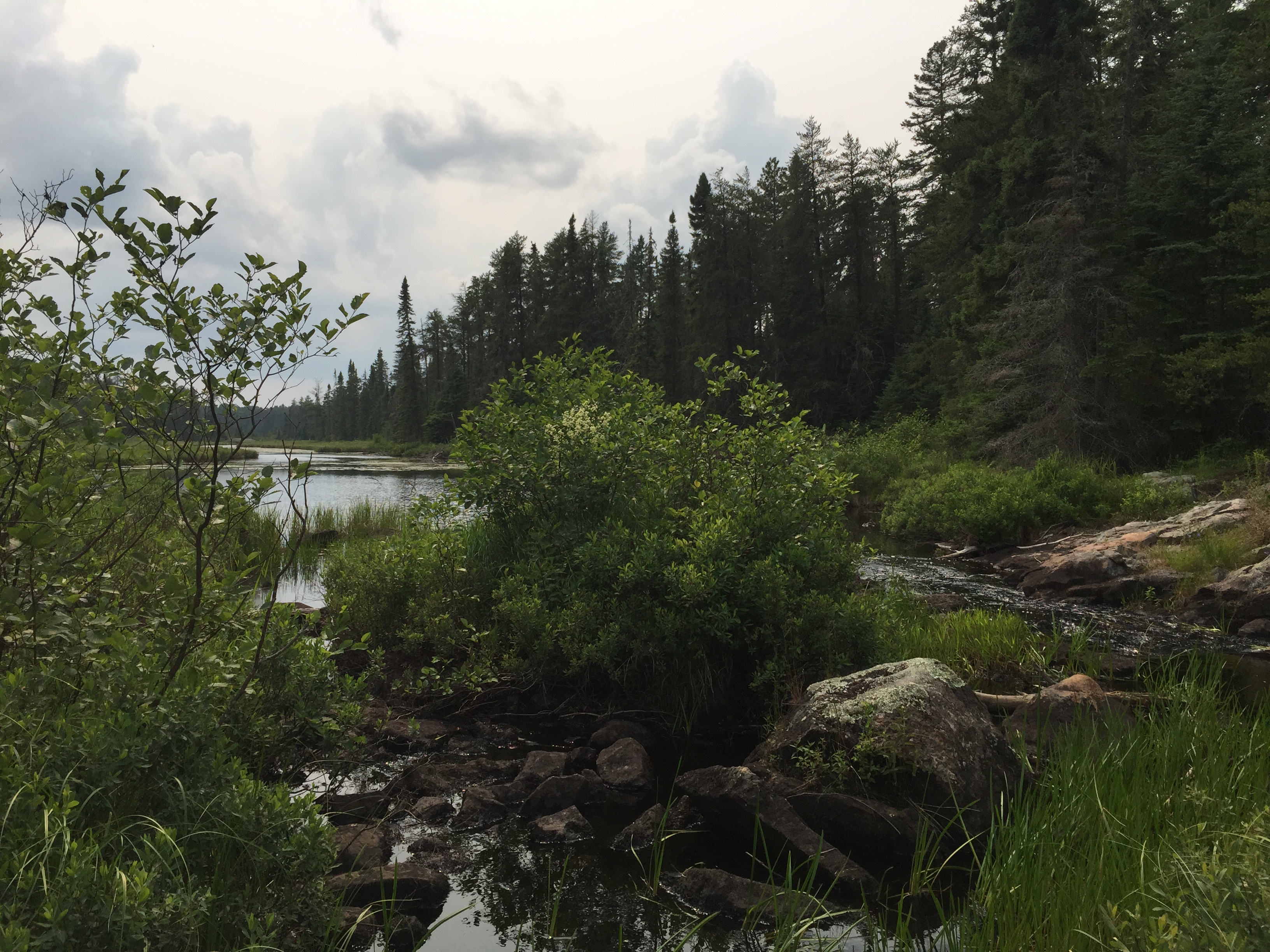
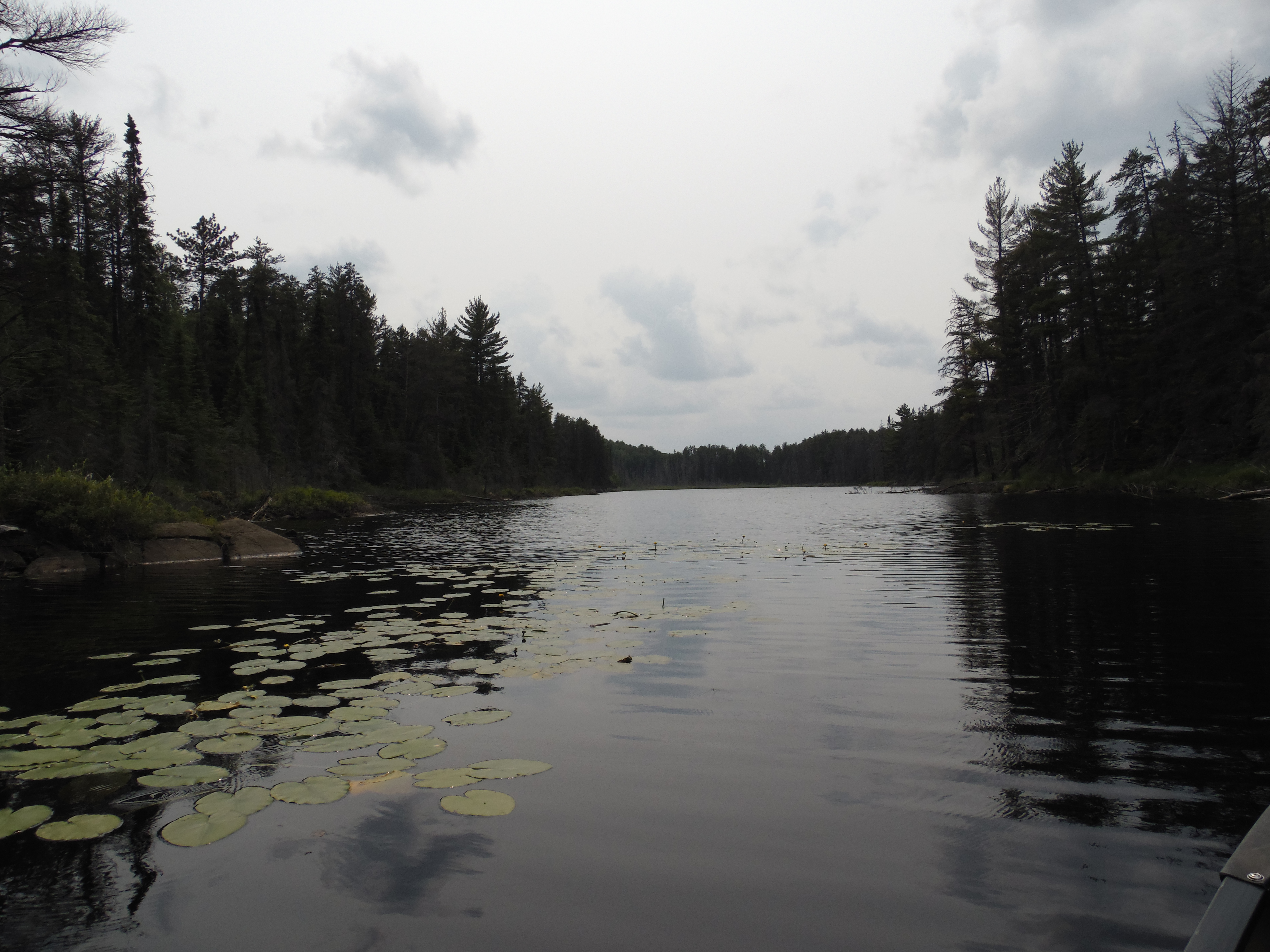
Beginning from Bridge Lake, paddle upstream through several million lily pads (mid-summer) until you reach a large pond. This pond is just a wide spot in the creek. Continue straight across the pond and plow through a few million more lily pads until you round a sharp bend and arrive at Drumstick Creek's first set of rapids. There is a formerly maintained portage to be found just below the rapids on the right side of the creek here. The portage is still very visible, but expect a lot of deadfalls and some overgrown spots along its route. The portage leads to Delta Lake. The portage (bushwhack) is no longer maintained because Delta Lake is in the Drag Lake Primitive Management Area.
View to the southwest of a rock outcropping on the south side of Drumstick Creek. This is on the west side of the pond. Drumstick Creek continues on the right side of your view. This is looking downstream.
A view along Drumstick Creek just downstream from the Delta Lake portage. A lily pad lovers paradise! ***********************************************END OF ROUTE***********************************************
BUSHWHACK FROM DRUMSTICK CREEK UPSTREAM TO DELTA LAKE
This is the start of the portage between Drumstick Creek and Delta Lake. You are taking this portage (which is no longer maintained) to avoid the rapids. This is the view in early spring with high water conditions. It is difficult to land a canoe here when the water is this high, so take care.
Here is roughly the same view of the portage landing (image above), but now you are here in midsummer (July). Water level is much lower.
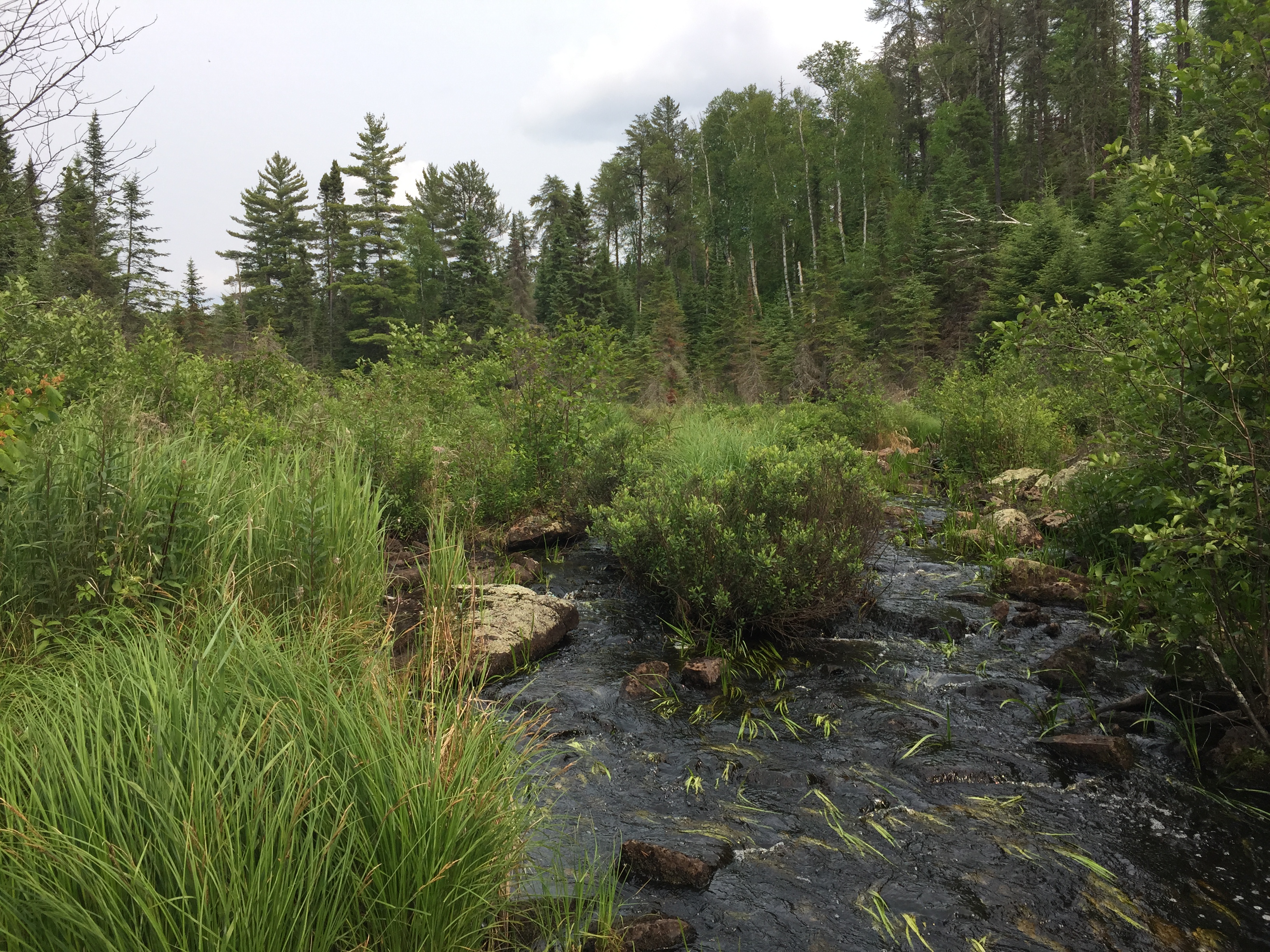
An easy bushwhack along a formerly maintained portage from Drumstick Creek to Delta Lake. Brushy with some downed trees lying across the path.
Delta Lake from the Drumstick Creek portage/bushwhack. Drumstick Creek flows out of Delta Lake just to your left.
A look at the start of the portage from Drumstick Creek to Delta Lake. ***********************************************END OF ROUTE***********************************************
Visit Delta Lake which is the logical next stop along Drumstick Creek.
PADDLING FROM DELTA LAKE UPSTREAM NEARLY TO QUARTZ LAKE
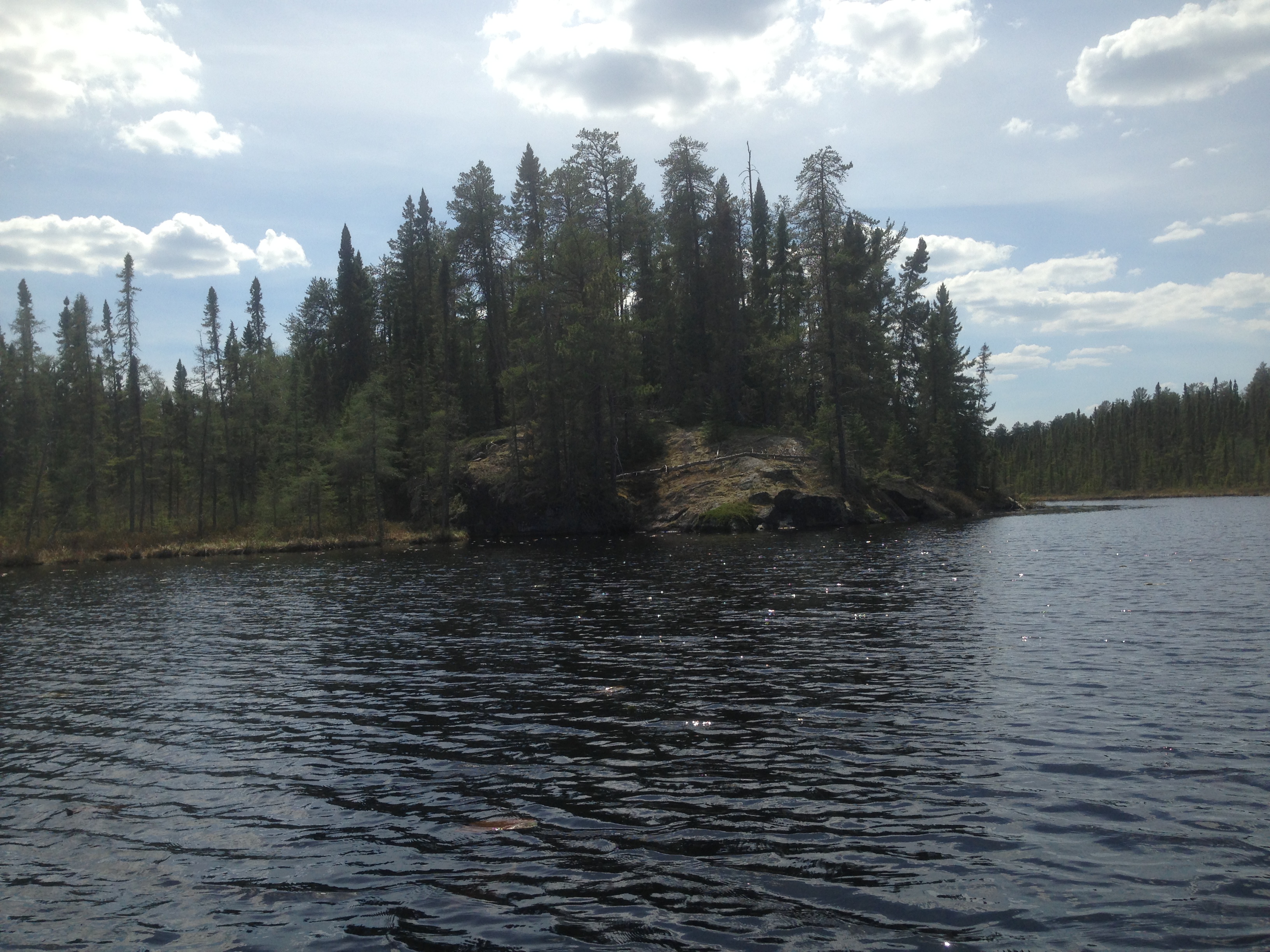
Just upstream of Delta Lake. Delta Lake visible in the distance.
A bit further on, you look back again toward Delta Lake. This is just upstream from the lake heading toward Quartz Lake.
By mid-summer this creek is covered in many places with lily pads.
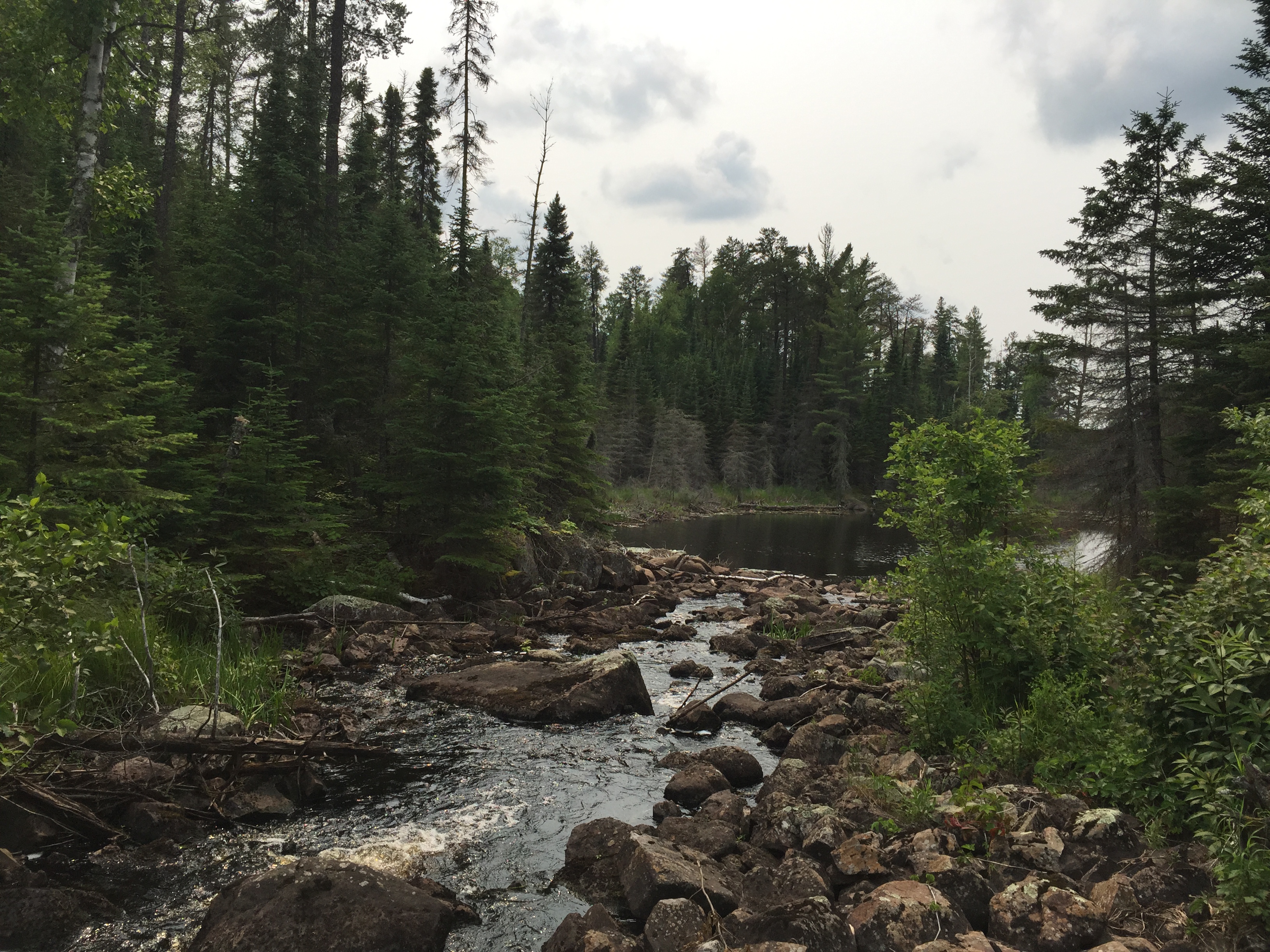
This is the first set of rapids you encounter as you head up Drumstick Creek from Delta Lake bound for Quartz Lake. You'll find it easier to walk through the shallow rapids than bushwhack through the brush along the banks of the creek.
Another view of the rapids, this time looking downstream.
If you look to your right while facing the second set of rapids, you can just make out a trail/canoe landing spot. It is right in the center of your view here.
You have reached a small pond where you discover the second set of rapids you've encountered since you left Delta Lake. You land your canoe at a little landing that is the start of a 5 rod portage through the forest to an unnamed lake beyond. This landing is just to the right of the rapids as you approach them, and the landing is not easy to spot. From where you are standing, to your right is the log choked set of rapids (by big boulder at right of view). Behind you is a portage trail leading into the forest that has seen at least occasional use.
At the end of the very short portage around the second rapids, you are greeted with this view as you clear the obscuring trees. This is the unnamed lake just upstream from Delta Lake. The downed tree in front of you makes it rough to launch a canoe, but the scenery makes up for it. From here you can plan to paddle to the left around that point.
Southwest corner of an unnamed lake upstream of Delta Lake along Drumstick Creek
Another view of the unnamed lake. This is where the faint trail used to bypass the second set of rapids reaches the lake shore.
Another view of the unnamed lake, but this time looking generally toward the east.
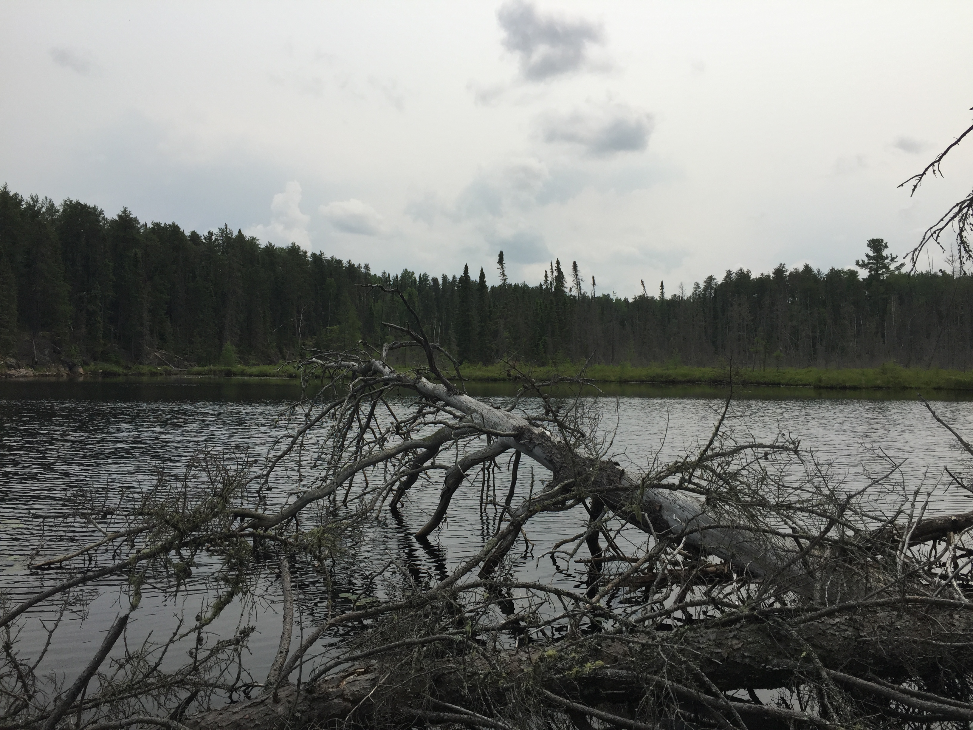
Leaving Delta Lake behind, you paddle your way upstream until you reach the first rapids (upstream of Delta Lake). It is fairly easy to just line or carry your canoe through this area. The water is shallow the the current isn't that strong (unless there has been heavy rains lately, then it may be different). At the head of these rapids you get back in your canoe and take a short paddle across a small pond. You soon come to the second set of rapids and these look a bit less appealing to drag a canoe up. You glance around a bit and alas, just to the right of the rapids, you spot what appears to be a nice place to land a canoe. There is even a "sort of" trail here, so you go with it and pop out at an unnamed lake of considerable size. You are now at the unnamed lake upstream from Delta Lake. A rather long and somewhat narrow lake. Standing here it will feel like you're the only person in the world as you are well into the Drag Lake PMA at this point. After expending some effort getting your canoe off the underwater rocks, you start paddling northeast (to the left) across this unnamed lake. At the east end of the lake, a narrow area exacerbated by low water levels, requires some nimble paddling and pushing to sneak through. A large log blocks much of the channel. After getting through the skinny spot, you keep paddling east (the lake much narrower and shallower now) until you arrive at the third set of rapids since leaving Delta Lake. After beaching the canoe at the bottom of the rapids, you bushwhack upstream and explore the route. This set of rapids appears like it will require a bit more effort to get around than the last two sets of rapids did. You eventually get to the head of these rapids and you stop at the south shore of a another pond. This is the pond (unnamed lake) that is just west of Quartz Lake.
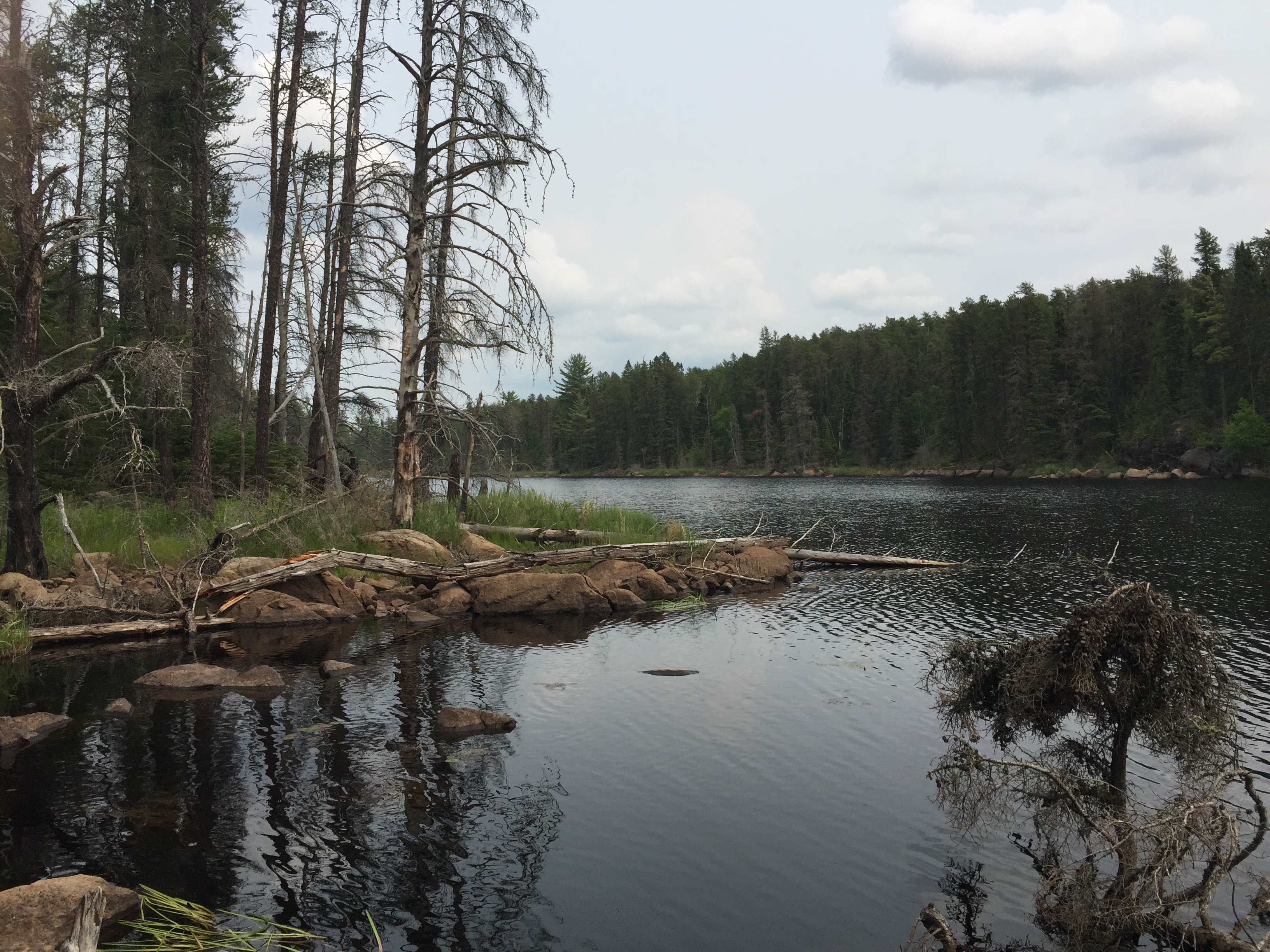
Just before coming to the narrow spot at the eastern end of the unnamed lake, you take a look back toward the west.
Standing at the base of the third set of rapids, looking to the west/southwest at the unnamed lake. In the center of your view is the pinch area that you passed through on the eastern end of that lake.
You look back in the direction of the long, narrow unnamed lake that you just passed through from about midway up the third set of rapids. You boulder hopped along these rapids to where you stand now.
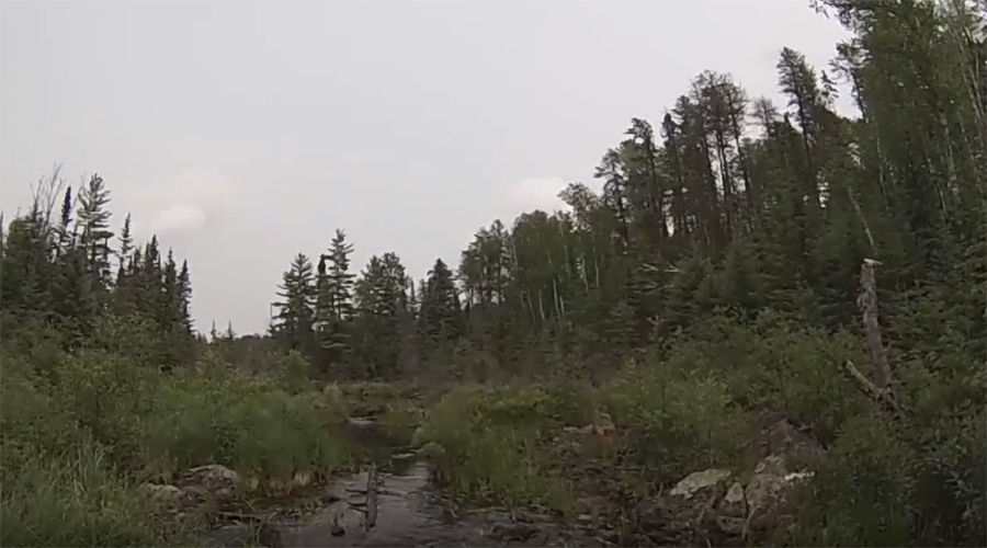
This is the view (blurry photo as it is taken from the video) just 20 feet downstream from the south shore of the pond that is just west of Quartz Lake. Looking toward the north. You are standing at the point where Drumstick Creek flows out of that pond. ***********************************************END OF ROUTE***********************************************