ROUTES/PORTAGES FROM SOUTH TEMPERANCE LAKE:
To Brule Lake (via short stretch of Temperance River): Walk the 10 rod portage
To North Temperance Lake: Walk the 55 rod portage
To Temperance River: Walk the 240 rod portage
South Temperance Lake
Tofte Ranger District
SOUTH TEMPERANCE LAKE CAMPSITES:
Campsite 1: (#907) - Easternmost campsite on this lake
Campsite 2: (#908) - Just north of the Temperance river portage
Campsite 3: (#909) - First campsite west of the North Temperance Lake portage
Campsite 4: (#910) - Located in the northwest corner of the lake
South Temperance Lake is a sprawling lake with many bays and a number of islands. This is in contrast to the other lakes strung out along the Temperance River which tend to be long and skinny; wider sections of the river.
The fishing on South Temperance Lake is good for the big three: northern pike, walleye and smallmouth bass. There are four campsites here; the one on the southeast point by the island being the most popular. This campsite has a wide view of much of the lake from an elevated position.
South Temperance Lake is a popular destination lake in this area. It is fairly close to BWCA Entry Point 41 - Brule Lake and also easily reachable in a day from the Baker Lake entry. So you may want to find a campsite early if you plan to stay on this lake.
This lake also serves as a crossroads to other routes in this part of the BWCA. To the east a short 10 rod portage along some rapids gets you into Brule Lake. Brule Lake is the source of the Temperance River, not South Temperance Lake. Portaging north from South Temperance Lake leads to North Temperance Lake. This is a relatively easy portage. North Temperance Lake is a much different lake than its sister, being clearer and deeper. Large cliffs/hills rise up to the east of North Temperance Lake. Continue this way past North Temperance Lake, the route will eventually take you up to Cherokee Lake. The portages between Cherokee Lake and South Temperance Lake are fairly challenging. Finally there is a southern exit from South Temperance Lake. This is along a 230 rod portage that generally parallels the Temperance River. This easily walked portage gains about 60 feet over its course and eventually ends at a wide and slow section of the river. Some evidence of the 1996 fire is still visible along this portage.
North Temperance Lake drains into South Temperance Lake through a small creek. The main source of water to the lake is from the Temperance River coming from Brule Lake. South Temperance Lake drains out through the Temperance River to the south.
Logging commenced for a short period around South Temperance Lake after the closing of the East Tofte Sale in 1961 (Heinselman, 1999).
A fire of about 4,450 acres started on June 14, 1996 as a result of a lightning strike. This fire burned from the eastern side of South Temperance Lake toward the southeast. The fire spread along the southwestern corner of Brule Lake, to the west end of Juno Lake and portions of Vern Lake and the Vern River. The fire was mostly out by the end of the month (Hansen, 2007). The fire cost and estimated $1.5 million (Beymer, 2006).
References:
Beymer, Robert, Boundary Waters Canoe Area – Volume 2 – Eastern Region (Berkeley: Wilderness Press, 2006), 58, 65-66, 68, 74, 86, 94, 110-111, 117-118, 133.
Hansen, Mary Alice, Sawbill: History and Tales (Tofte: Sawbill Press, 2007)
Heinselman, Miron, The Boundary Waters Wilderness Ecosystem (Minneapolis: University of Minnesota Press, 1999), 120.
Pauly, Daniel, Exploring the Boundary Waters (Minneapolis: University of Minnesota Press, 2005), 251, 261.
Click on the photos below to see the full resolution image - Use your browsers back button to close photo and return to this page.
PADDLING FROM THE TEMPERANCE RIVER PORTAGE TO THE BRULE LAKE PORTAGE
Evening paddle across the lake between these two portages. Portage to Brule Lake -or- Explore Another Route ***********************************************END OF ROUTE***********************************************
PADDLING FROM THE BRULE LAKE PORTAGE TO THE TEMPERANCE RIVER PORTAGE
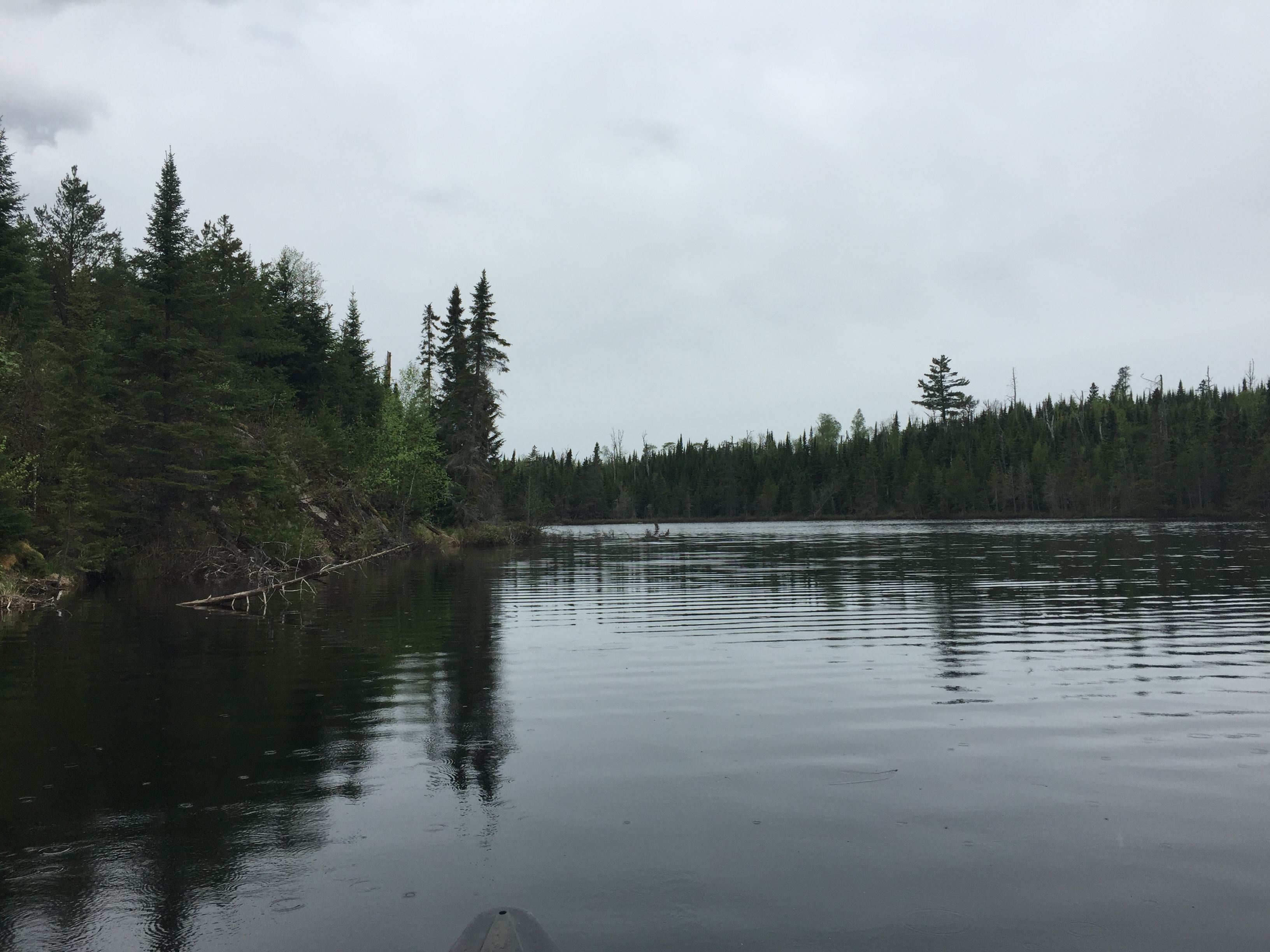
View toward the west from the east end of South Temperance Lake near the mouth of the Temperance River, which flows in here coming from Brule Lake. The only way to go here is to the left (west). The lake only extends back into a small bay for a couple hundred feet to the right (east).
Looking west as you prepare to enter the wider western part of South Temperance Lake. This view is from the narrow, east part of the lake.
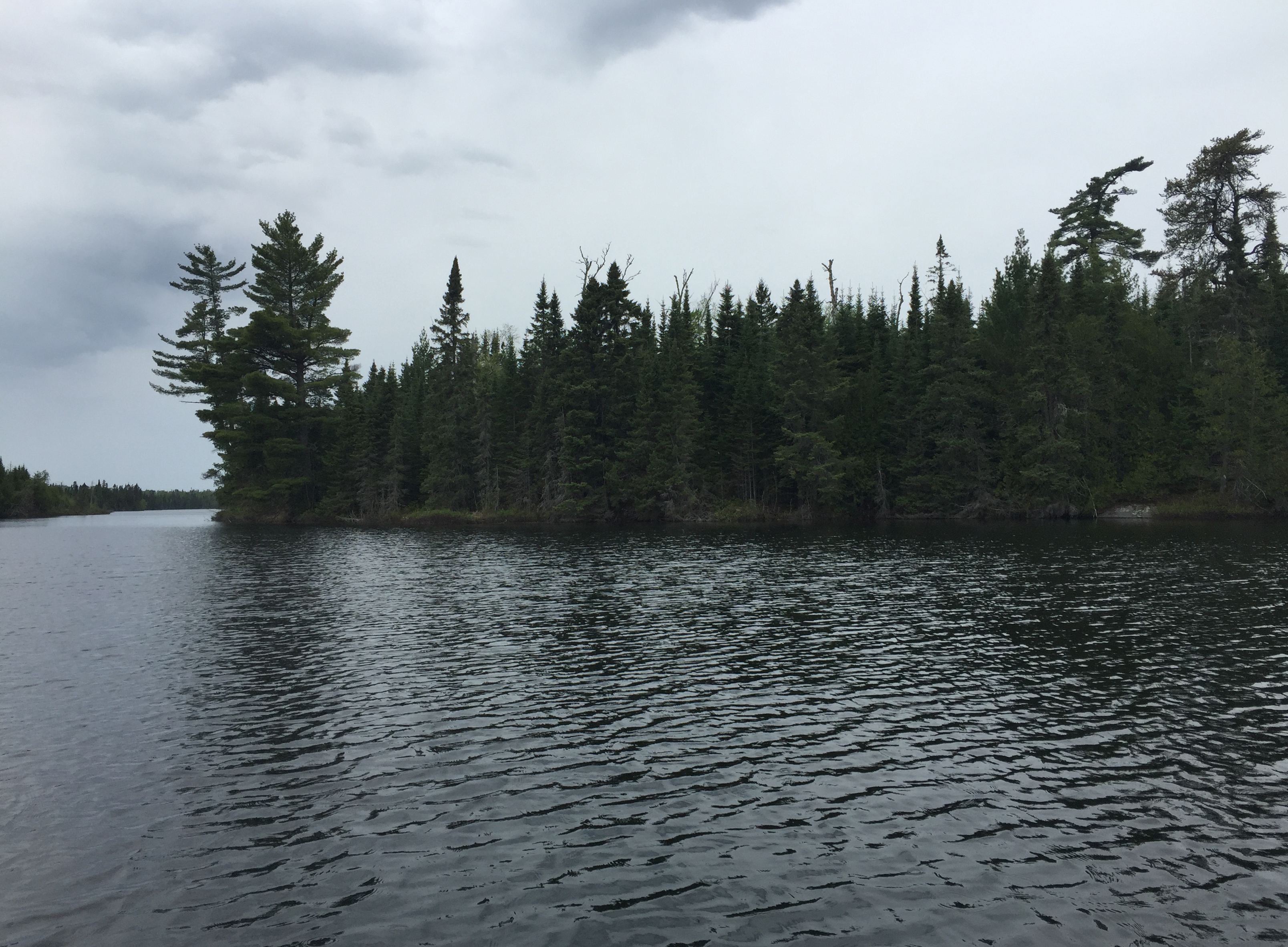
The Temperance River gradually widens into South Temperance Lake. From this point, paddle until passing the large pine tree on the point (along north shore). From the point, paddle westward until you near the small island around the center of the lake. This island is north of the campsite on the point, that extends from the south part of the lake. You continue paddling until reaching the south end of the lake and the start of the long portage along the Temperance River.
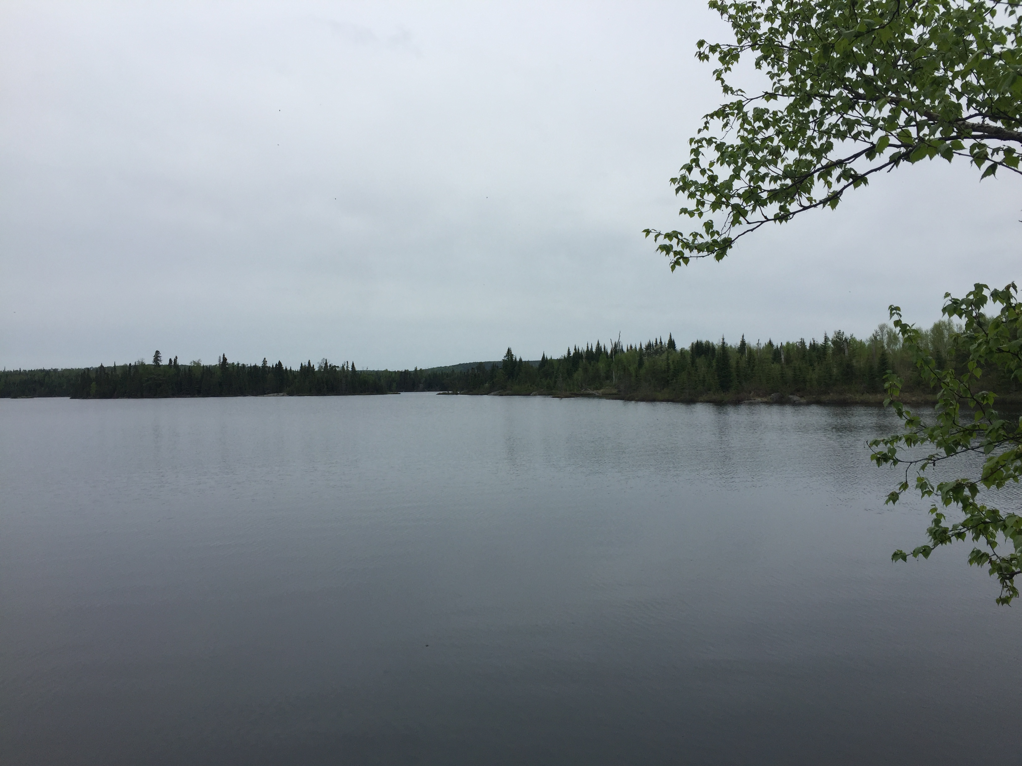
This view extends from the northwest to the northeast and encompasses most of the more open part of South Temperance Lake. You are standing at the Temperance River portage. This is a 240 rod portage that leads to a wide, slower flowing section of the Temperance River. It is an easy trail to walk and is generally downhill from this point.
View is toward the north/northeast in the direction of the campsite located on the point. You are standing at the start of the portage to the Temperance River. Portage to the Temperance River -or- Explore Another Route ***********************************************END OF ROUTE***********************************************
Route Connections for South Temperance Lake
From South Temperance Lake, you can portage to Brule Lake, North Temperance Lake or into the Temperance River.