ROUTES/PORTAGES FROM SHRIKE LAKE:
To North Branch Cascade River: Paddle In
Shrike Lake
Tofte Ranger District
The only views of Shrike Lake are from long distance images taken from near the summit of Eagle Mountain. Shrike Lake lies right at the base of Eagle Mountain on its west flank. The surface of Shrike Lake is about 475 vertical feet below the summit.
There are several lakes that can be seen from the top of Eagle Mountain, namely: Eagle Lake, Shrike Lake and Zoo Lake. The North Branch Cascade River is also visible on a clear day. In addition, it is also probably possible to see Crow Lake from Eagle Mountain, but not from the vantage point that the views shown on this web page were taken from.
Note: Cascade Lake is also visible from the Eagle Mountain summit area (out beyond Shrike Lake and Zoo Lake), but it is not within the Boundary Waters Canoe Area (BWCA).
There are no standard canoe routes into any of these lakes, so an easy way to see them is from the top of Eagle Mountain. To reach any of these lakes from ground level would require a substantial bushwhacking effort.
Shrike Lake contains northern pike. Even though it is relatively inaccessible, the Minnesota DNR has done a fish survey on this lake.
Exploring Shrike Lake
Click on the photos below to see the full resolution image - Use your browsers back button to close photo and return to this page.
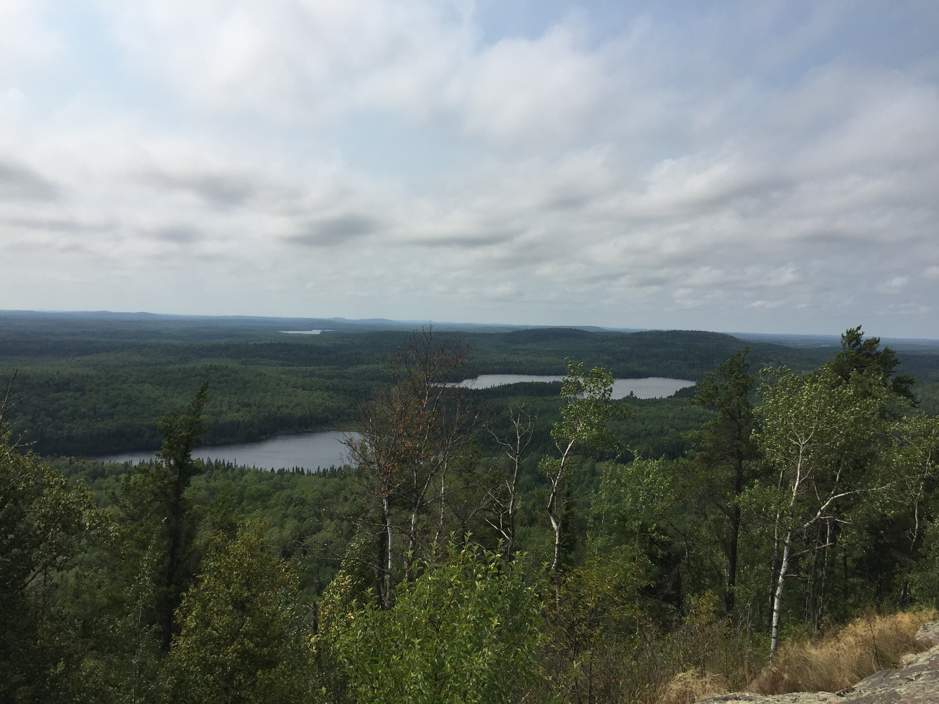
Shrike Lake is just right of the middle of your view. You are looking south from the top of Eagle Mountain.
Shrike Lake close up from summit of Eagle Mountain. Cascade Lake can be seen in the far distance.
A breezy day has you looking down at Shrike Lake (center), Zoo Lake (to the right) and far off Cascade Lake.
Close up of Shrike Lake. Wind buffets you from your view point near the summit of Eagle Mountain.
View of Shrike Lake from top of Eagle Mountain.
Shrike Lake visible on the left. Zoo Lake is on the right in the distance.