Wildlife Seen on Visit: Loons, Bald Eagle, Seagulls, Ducks
Last Visited: May 25, 2015
Lake Elevation: 1549 feet
Water Clarity:
ROUTES/PORTAGES FROM MALBERG LAKE:
To River Lake (a wide point of the Kawishiwi River): Walk the 62 rod portage
To Kawishiwi River: Walk the 90 rod portage (this is on north side of east arm of lake)
To Boze Lake: Walk the 18 rod portage, then a 6 rod portage and finally an 11 rod portage
To Koma Lake: Walk the 24 rod portage along the Kawishiwi River
Malberg Lake
Tofte Ranger District
MALBERG LAKE CAMPSITES:
None visited yet.
Once you reach Malberg Lake, you have a ton of options for routes into other areas of the BWCA. Out of the northwestern bay of Malberg Lake you can head to Fishdance Lake, which has an interesting pictograph site. Alice Lake also in that direction. That lake has many sandy beaches to explore. You can also travel out to Frond Lake and Boze Lake along the Louse River route. From the northeastern bay of Malberg Lake you can head up toward Kivaniva Lake, Pan Lake and eventually Makwa Lake.
Malberg Lake has many long and narrow arms to explore. The fishing on Malberg Lake is consistently reported to be very good. The lake is well known for walleye production. There is a good walleye hole right below the rapids from Koma Lake. Northern pike can be caught right in those rapids too, from the Malberg Lake end of the portage.
Campsites are usually easy to find on Malberg Lake. It is remote enough from any entry point to typically be uncrowded.
Water flows into Malberg Lake via the Kawishiwi River at the south end of the lake. The Kawishiwi River flows out from the lakes northeastern arm. The Louse River also flows into the southern bay of Malberg Lake long its eastern shoreline.
Much of the forest (particularly the north and northeast side of the lake) around Malberg Lake is virgin pine and is over 100 years in age. The rest of the shoreline was logged in the last century as part of the Tomahawk Sale transaction that was consummated in 1945. Logging roads extended from Forest Center near Lake Isabella, as far as the south side of Malberg Lake. Logging ended in the area by the early 1960's (Heinselman, 1999).
References:
Beymer, Robert, Boundary Waters Canoe Area – Volume 2 – Eastern Region (Berkeley: Wilderness Press, 2006), 47, 53, 62, 71, 141, 150.
Heinselman, Miron, The Boundary Waters Wilderness Ecosystem (Minneapolis: University of Minnesota Press, 1999), 98, 116, 150, 200, 279.
Pauly, Daniel, Exploring the Boundary Waters (Minneapolis: University of Minnesota Press, 2005), 238, 239, 241, 255.
Click on the photos below to see the full resolution image - Use your browsers back button to close photo and return to this page.
PADDLING FROM THE KOMA LAKE PORTAGE TO THE SOUTH ED OF THE WEST BAY OF THE LAKE
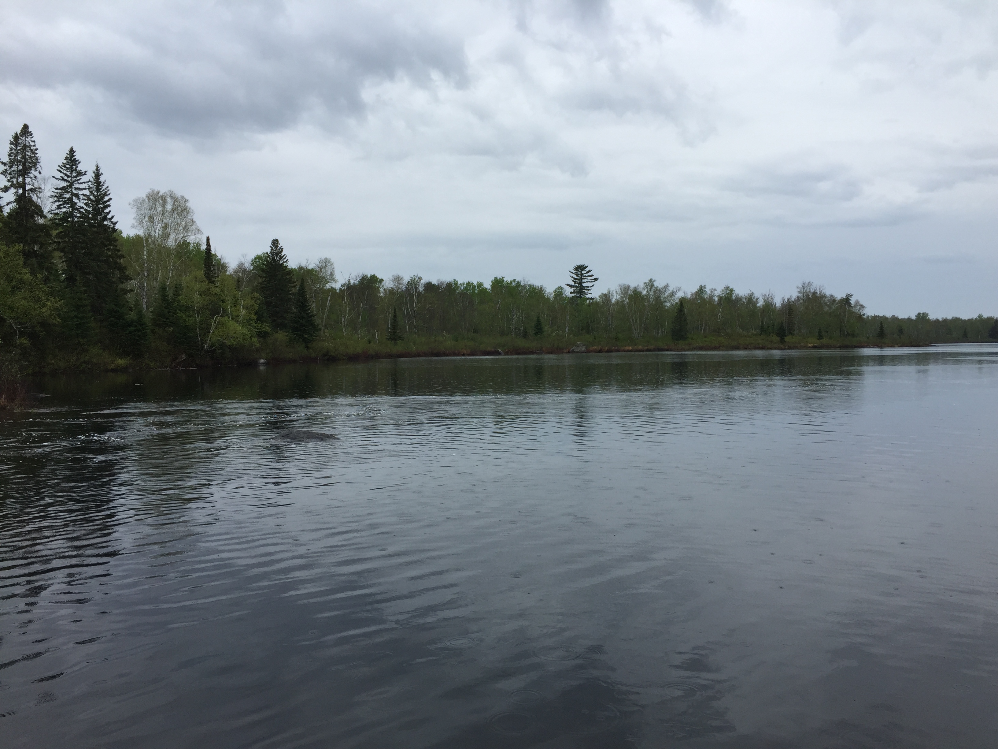
A scenic spot on Malberg Lake is where the Kawishiwi River comes rushing into the lake. You can often catch fish here right in the rapids.
Looking north from the end of the Koma Lake portage. The Kawishiwi River flows into Malberg Lake just to your left. This is a good place to catch walleyes where the current from the rapids dies out and the water deepens.
Beginning from the portage leading back to Koma Lake, you start north across Malberg Lake, staying near to the lakes west shore. Explore Another Route ***********************************************END OF ROUTE***********************************************
PADDLING FROM SOUTH END OF WEST BAY OF LAKE TO THE RIVER LAKE PORTAGE
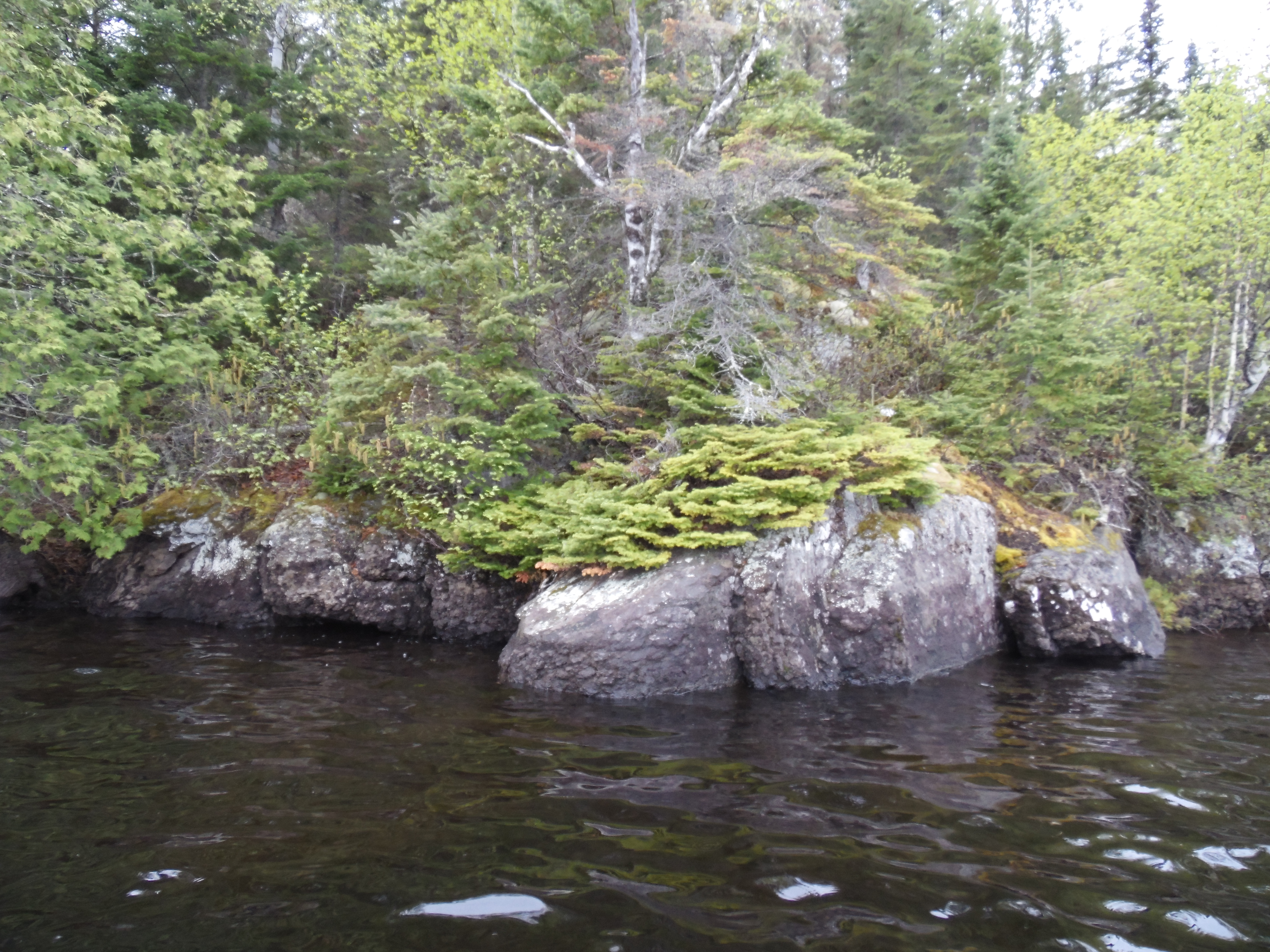
Passing by rock formations highlighted with bright green ground hugging pine, as you paddle the western shoreline in the west most bay of Malberg Lake.
Paddling from the south end of the western bay of Malberg Lake toward the north, along the west shoreline.
Ending a long paddle across Malberg Lake, you pull up to the 62 rod portage that leads to River Lake near to the mouth of Record Creek. River Lake is a wide section of the Kawishiwi River.
You're looking due east from the start of the 62 rod portage, which is located at the western tip of Malberg Lake. This portage can be very wet. During some wet periods, a section of this portage passes through knee deep standing water where it traverses a pond. The portage comes out at the Kawishiwi River. Go this way if you are headed toward Fishdance Lake. Portage to River Lake -or- Explore Another Route ***********************************************END OF ROUTE***********************************************
Route Connections for Malberg Lake
From Malberg Lake, you can portage to the Kawishiwi River (which flows through Malberg Lake) or Frond Lake. You can also portage to River Lake from the north end of Malberg Lake's western bay.