Last Visited: May 12, 2023;
Previous Visit(s): July 25, 2021, July 10, 2016
River Elevation: Along its course, the Island River drops from 1643 feet at its headwaters at Silver Island Lake to about 1556 feet where it drains into the Isabella River.
Water Clarity: N/A
ROUTES/PORTAGES FROM THE ISLAND RIVER:
To Isabella River: Paddle In
Island River
Tofte Ranger District
ISLAND RIVER CAMPSITES:
None visited yet.
It will be obvious to anyone visiting here that this area took a major hit from the 2011 Pagami Creek Fire. The river now feels very exposed and would not make for easy paddling on a windy day.
Only a short section of the Island River is within the Boundary Waters Canoe Area. This section is from BWCA Entry Point 34 downstream to the Isabella River. About one and a half miles. It is a total of three miles from the Island River entry point to Lake Isabella.
The most interesting place on the Island River is not in the BWCA at all. Rather, it is upstream from the entry point canoe landing. The place in question is a Native American pictograph site. The site is particuarly noteworthy because the pictographs are large (most pictograph images are fairly small). The pictograph site is about 4 1/2 miles upstream from the BWCA entry point. Two portages are also required to visit it.
Here is a good web page from the U.S. Forest Service about the Island River (just outside of the BWCA).
There are no campsites along the Island River from the entry point down to the mouth at the Isabella River. Many of the campsites on the Isabella River and on Lake Isabella were destroyed or damaged by the Pagami Creek Fire. Some of these may have been restored.
There are two campsites along the Island River upstream from the entry point. Neither of these campsites are in the BWCA. These campsites are useful to paddlers heading upriver to visit the pictographs. It is possible to follow the Island River until at least its confluence with the Dumbbell River.
The Island River flowed just south of the former location of Forest Center, a logging era town inhabited mostly by loggers and their families who made their living working for the Tomahawk Timber Company. The town had a population around 250 at its peak. From Forest Center an extensive network of roads extended out from that central hub. Several of these roads criss-crossed the Island River. Most of the forest along the Island River was logged between 1940 and the early 1960's. Forest Center ceased to exist in 1964, when the industry that supported it disappeared. Logging was prohibited in what is now the BWCA starting in 1964 (Pauly, 2005).
References:
Beymer, Robert, Boundary Waters Canoe Area – Volume 1 – Western Region (Berkeley: Wilderness Press, 2006), 236, 238, 240.
Pauly, Daniel, Exploring the Boundary Waters (Minneapolis: University of Minnesota Press, 2005), 217-221.
Click on the photos below to see the full resolution image - Use your browsers back button to close photo and return to this page.
VIEW OF THE ISLAND RIVER FROM BWCA ENTRY POINT 34
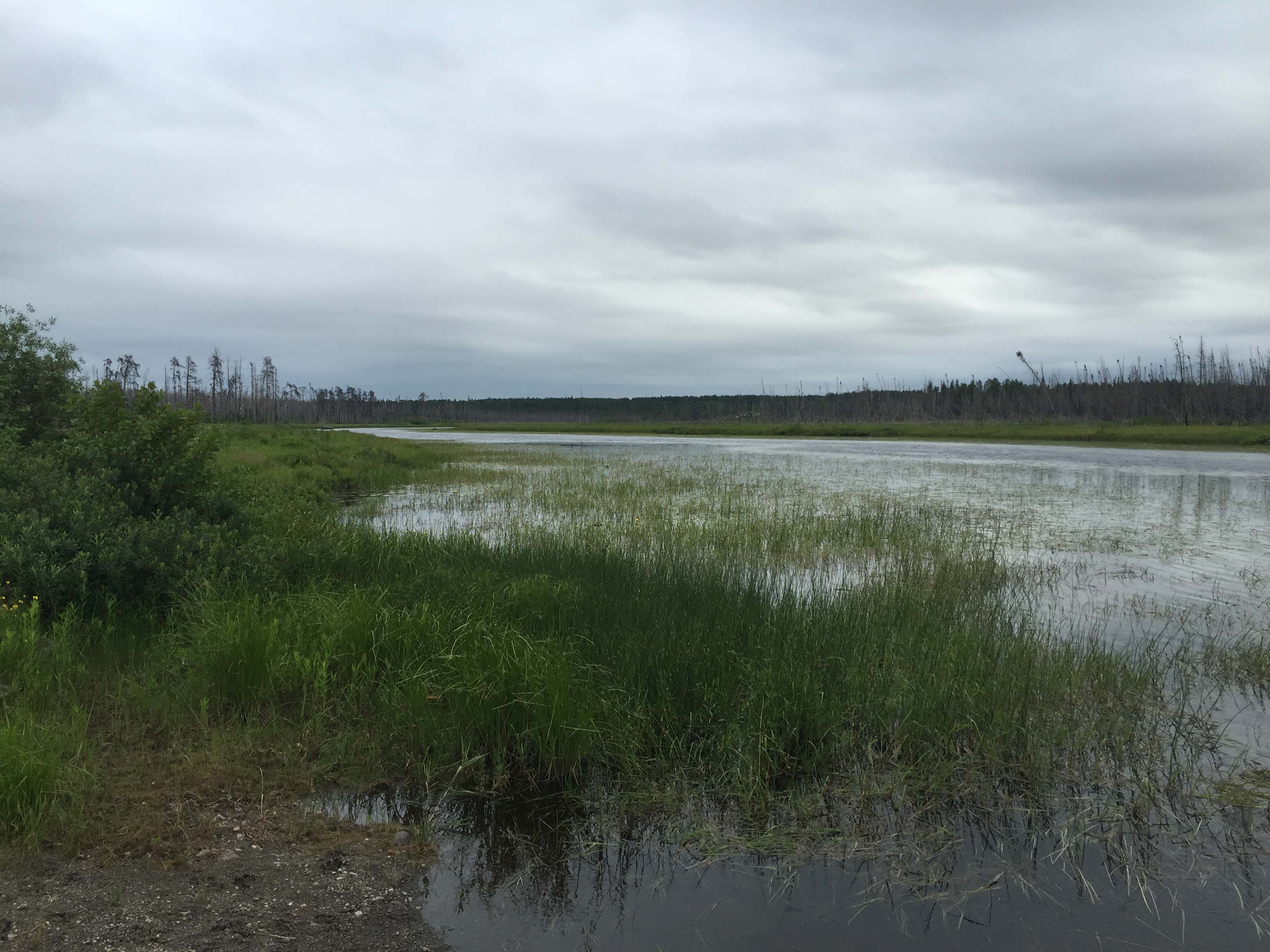
View upriver during high water from the Entry Point 34 bridge crossing.
The view of the Island River from the BWCA Entry Point 34 parking lot. The BWCA officially begins after you pass under that bridge to the right. That direction leads to the Isabella River. If you head to your left, about 4 1/2 miles upstream is the location of a pictograph site which is outside of the BWCA (July 10, 2016).
View of the bridge when river levels were low during a drought year (July 25, 2021).
Looking upstream from the Island River entry point landing. Low water levels (July 25, 2021).
Looking upstream to the left from the BWCA Entry Point 34 parking lot (July 10, 2016).
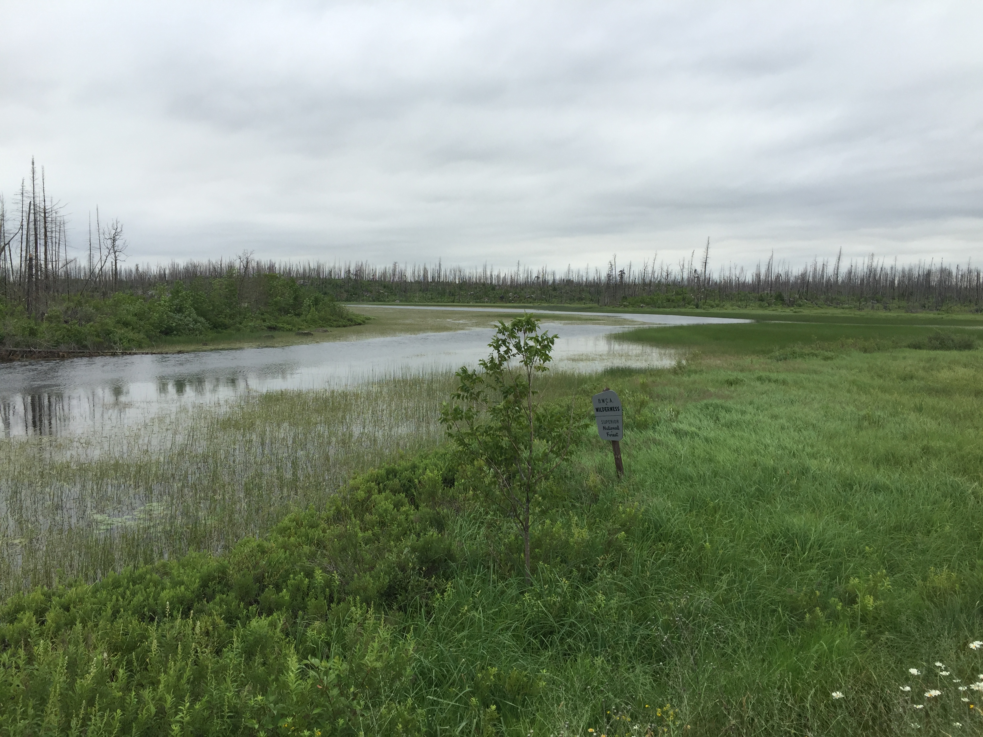
If you walk across the road from the entry point parking lot, you can see well downstream. The sign marks the official boundary for the BWCA (July 10, 2016).
The Island River from near BWCA Entry Point 34 (July 10, 2016).
Route Connections for the Island River
From the Island River you can paddle into the Isabella River. You can also leave the wilderness via BWCA Entry Point 34.