Stuart Lake
Kawishiwi Ranger District
STUART LAKE CAMPSITES:
None visited yet.
Gorgeous Stuart Lake has four islands and approximately eight miles of shoreline. It acts as a hub for a number of route options. You can exit out the Dahlgren River and head up toward Lake Agnes and Lac La Croix, a popular route. A long portage out of the northeast corner of the lake heads to Fox Lake and big Iron Lake beyond. The portage to Fox Lake is mostly level terrain. The Stuart River leads to the BWCA Entry Point 19 parking lot. Access to the Sundial Lake Primitive Management Area from the east shore of Stuart Lake is also possible, if you want to visit Nibin Lake.
If you are into fishing, Stuart Lake supports gobs of small walleye and some good-sized pike.
The campsite on the east shoreline just south of the Fox Lake portage is probably the best of the lake's five campsites.
Water flows into Stuart Lake through the Stuart River. The Stuart River comes into the lake over a waterfall that can be impressive if the water is high. Stuart Lake empties into the Dahlgren River and flows to the north toward sprawling Lac La Croix.
The forest around Stuart Lake is relatively mature, as no major fires have affected the area for well over a century (Heinselman, 1999).
References:
Beymer, Robert, Boundary Waters Canoe Area – Volume 1 – Western Region (Berkeley: Wilderness Press, 2006), 111, 114, 121, 122, 124, 145.
Heinselman, Miron, The Boundary Waters Wilderness Ecosystem (Minneapolis: University of Minnesota Press, 1999), 120, 122.
Pauly, Daniel, Exploring the Boundary Waters (Minneapolis: University of Minnesota Press, 2005), 124, 126.
Exploring Stuart Lake
Click on the photos below to see the full resolution image - Use your browsers back button to close photo and return to this page.

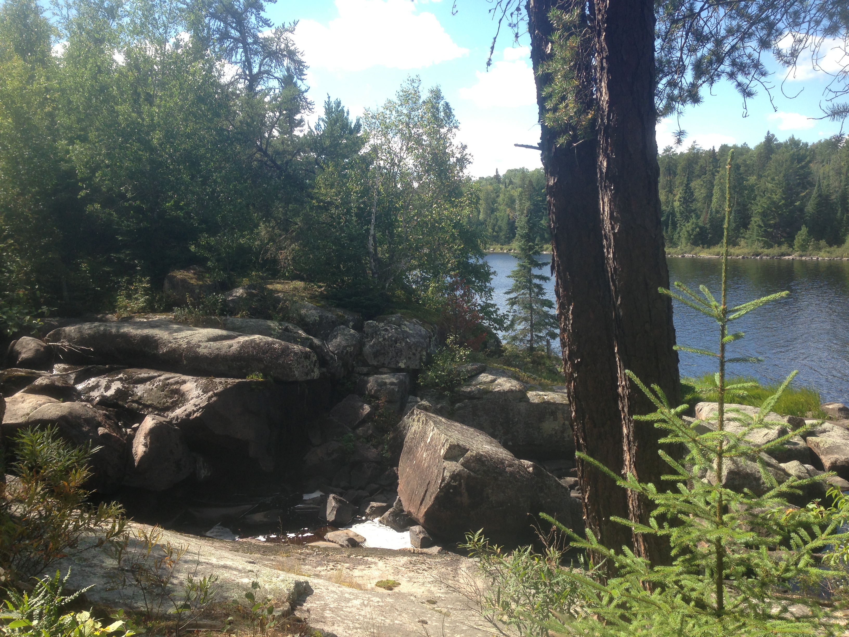
Stuart River Falls during low water in September. It is much more impressive when the water is high.
You take in this view up on the east shoreline of Stuart Lake. Here you are standing at the end of the Stuart River portage just east of the waterfall.
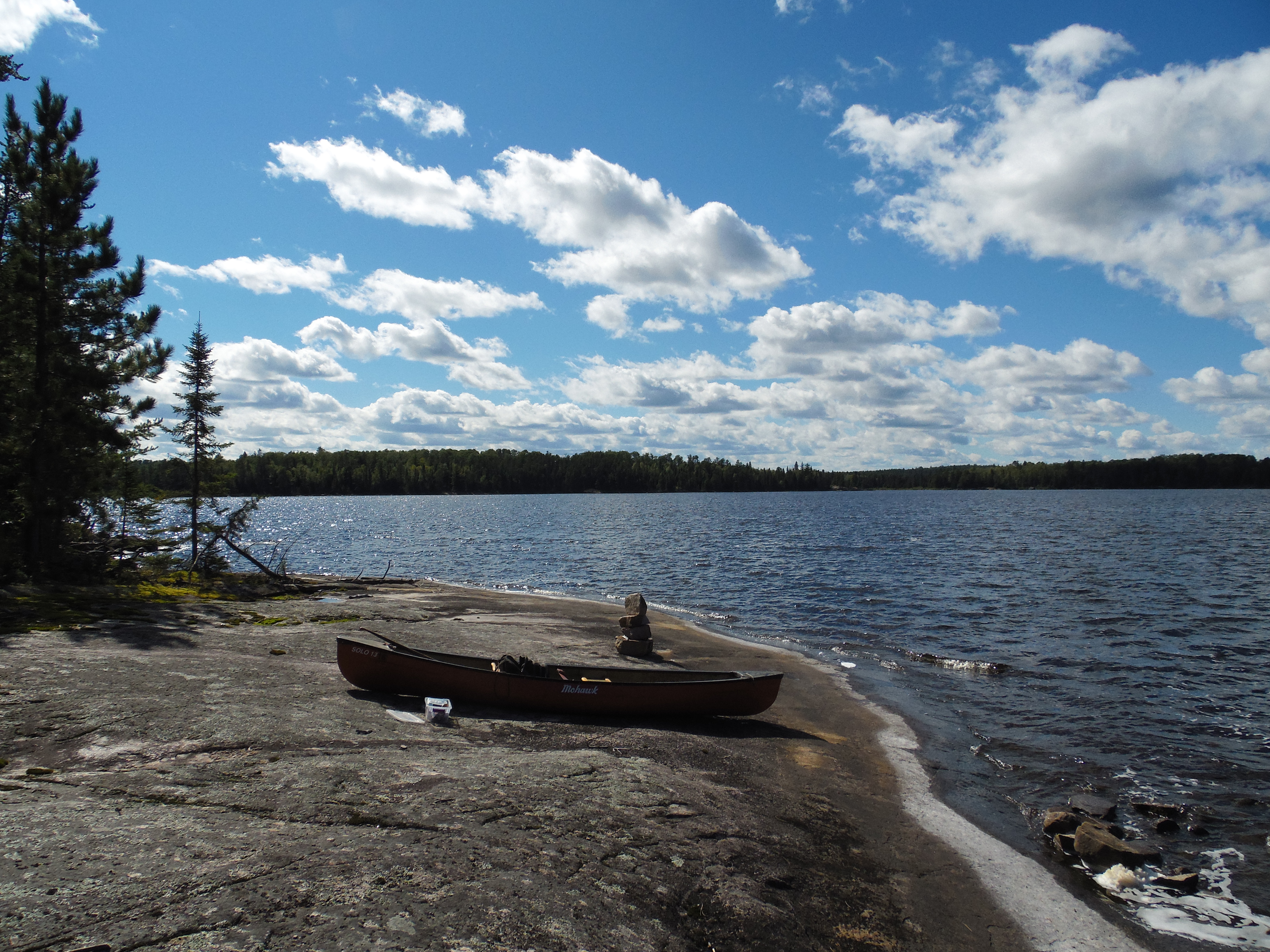
About a half mile up the east shore of Stuart Lake from the Stuart River portage, you will see this large flat rock shelf. You may also notice cairns built upon it. The cairns are there to mark the location of the Nibin Lake portage. This portage is now more of a bushwhack and no longer is displayed on new maps of the BWCA. The bushwhack is 180 rods and leads to Nibin Lake in the Sundial Lake Primitive Management Area (PMA).
From the lakeshore, walk up to the edge of the forest where the old, now unmaintained portage trail begins that leads to Nibin Lake.
Route Connections for Stuart Lake
From Stuart Lake, you can portage to Fox Lake, the Dahlgren River or the Stuart River. You can also bushwhack about 180 rods to Nibin Lake in the Sundial Lake Primitive Management Area.
Return to Top of Page
|