MISSING LINK LAKE CAMPSITES: Campsite 1 (#547): North side of lake near Round Lake portage Campsite 2 (#549): South end of lake near Tuscarora Lake portage Campsite 3 (#548): Mid-lake point
There are three maintained portages into Missing Link Lake. From Round Lake, a 142 rod portage ends at the edge of the northwest bay of Missing Link Lake. This portage is uphill if coming from Round Lake and it is not easy. Another portage from Missing Link Lake is found in the northeast bay. This is the 160 rod portage to Snipe Lake. Finally, there is a long and difficult portage from Missing Link Lake to Tuscarora Lake. This portage is easier if you are heading toward Tuscarora Lake, as it it generally downhill in that direction. It's a tough portage no matter which way you are going though.
There is another portage (not shown or shown in the wrong location on most maps) to Mavis Lake that is in the northeast end of the northeast bay of Missing Link Lake. This is the trail the Minnesota DNR uses to get into Mavis Lake to stock it with brook trout. The McKenzie maps incorrectly show that the portage to Mavis Lake splits off from the Snipe Lake to Missing Link Lake portage. Fisher and Voyageur maps don't show the portage at all. It's also debatable if you can even call this a portage; it is closer to being a bushwhack. You can actually see this portage on Google Maps satellite images. The portage is roughly 40 rods in length. The trail can be hard to follow.
There are three campsites on Missing Link Lake, but they can fill up fast. This is because of the lakes close proximity to the entry point and also because of the campers who are here to fish for the lakes brookies. The campsite on the point is probably the best with wide views of the lake, while also offering some cross breezes to keep the bugs at bay.
Missing Link Lake has been stocked with brook trout since at least the 1990's. Since 2005, the Minnesota Department of Natural Resources has stocked the lake with around 2,000 brook trout fingerlings per year. Brook trout have to be stocked regularly because they don't reproduce in lakes. Missing Link Lake is only 25 feet deep, but that seems to be sufficient to supply the cool water that brook trout prefer. The water of Missing Link Lake is quite clear.
Missing Link Lake appears to be landlocked. Because the water doesn't escape the lake through any drainages, it makes it suitable for the Minnesota DNR brook trout stocking program.
Nearby Mavis Lake also contains brook trout, but the lake is difficult to reach.
References:
Beymer, Robert, Boundary Waters Canoe Area – Volume 2 – Eastern Region (Berkeley: Wilderness Press, 2006), 136, 142, 144, 146, 150, 157, 166, 205.
Pauly, Daniel, Exploring the Boundary Waters (Minneapolis: University of Minnesota Press, 2005), 316, 325, 326.
Click on the photos below to see the full resolution image - Use your browsers back button to close photo and return to this page.
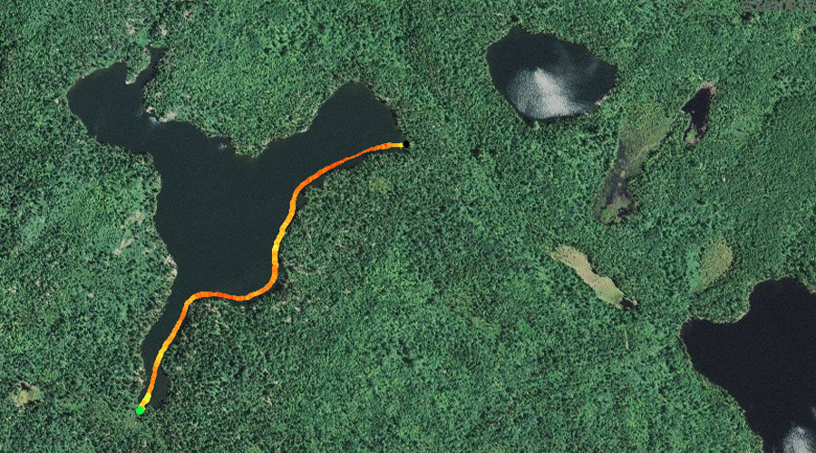
PADDLING FROM THE TUSCARORA LAKE PORTAGE TO THE ROUND LAKE PORTAGE
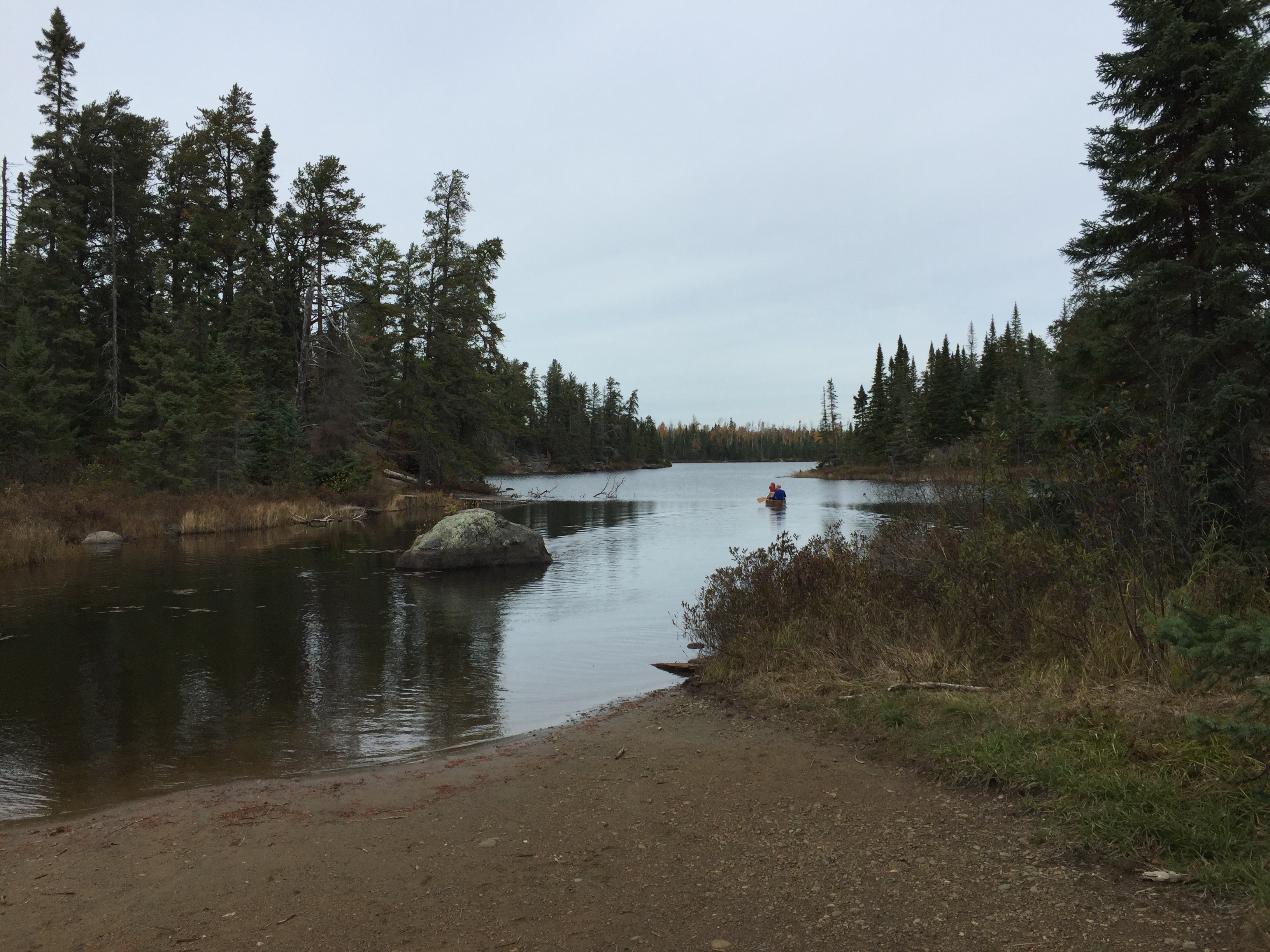
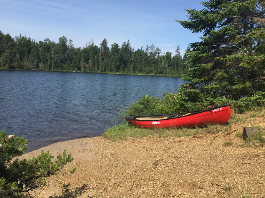
A canoe leaving the Tuscarora Lake portage landing.
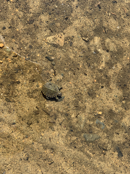
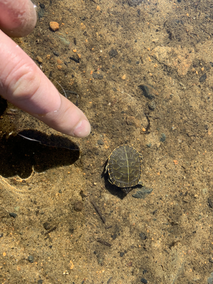
Freshly hatched painted turtles in the sandy shallows right by the Tuscarora Lake portage.
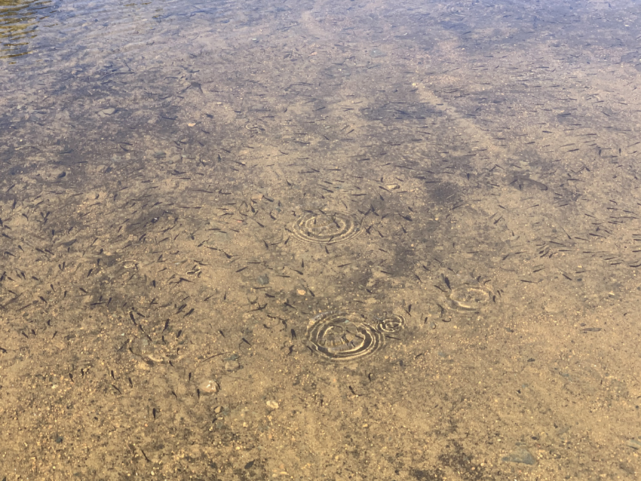
A few thousand minnows with a couple dozen tadpoles mixed in. This is near the beginning of the Tuscarora Lake portage on Missing Link Lake.
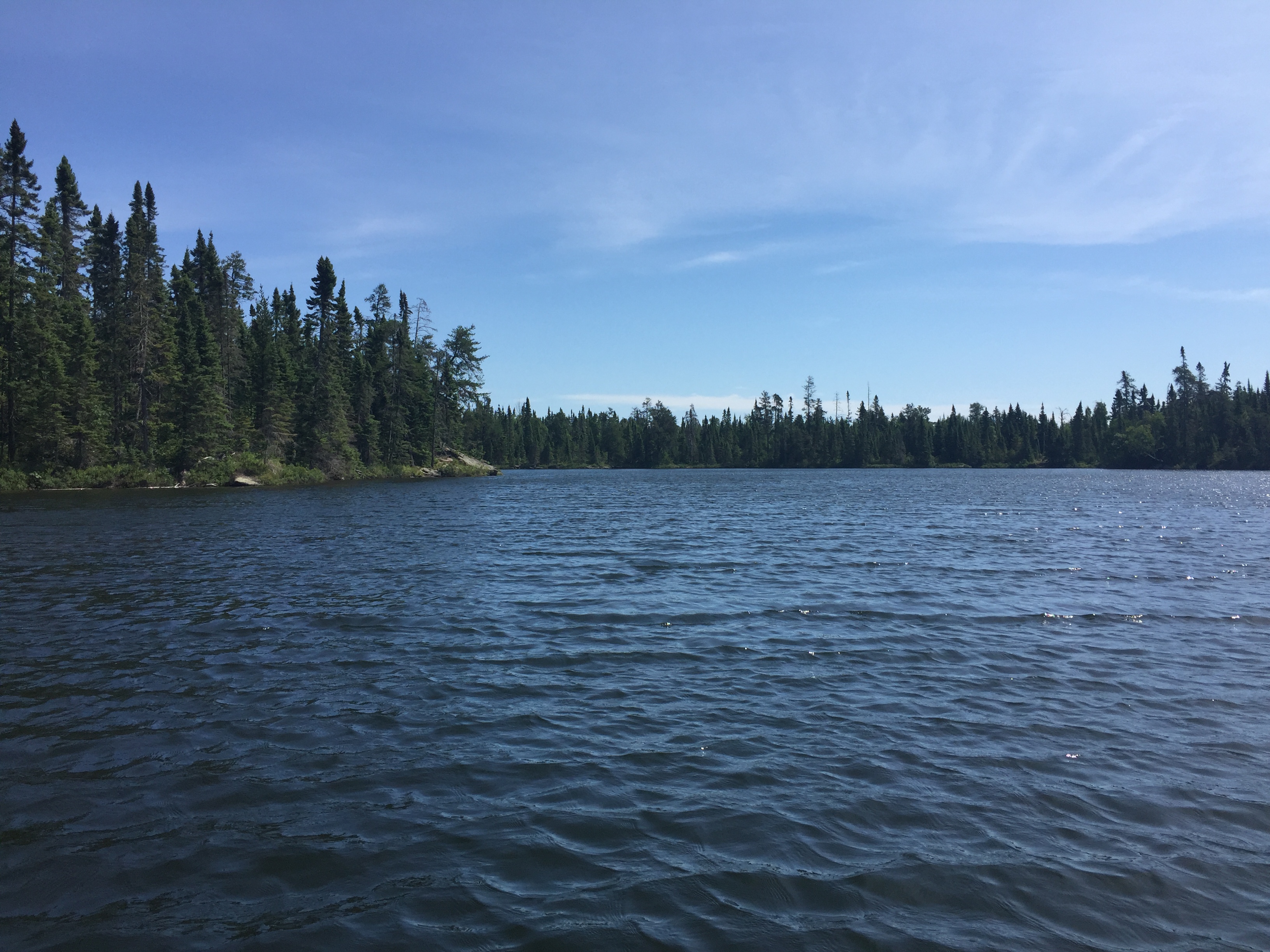
A paddle across the 37 acres of Missing Link Lake. You paddle from the Tuscarora Lake portage at the very south end of the lake, pit stop at two campsites along the way and then head up to the northwest bay of the lake where the portage to Round Lake is located.
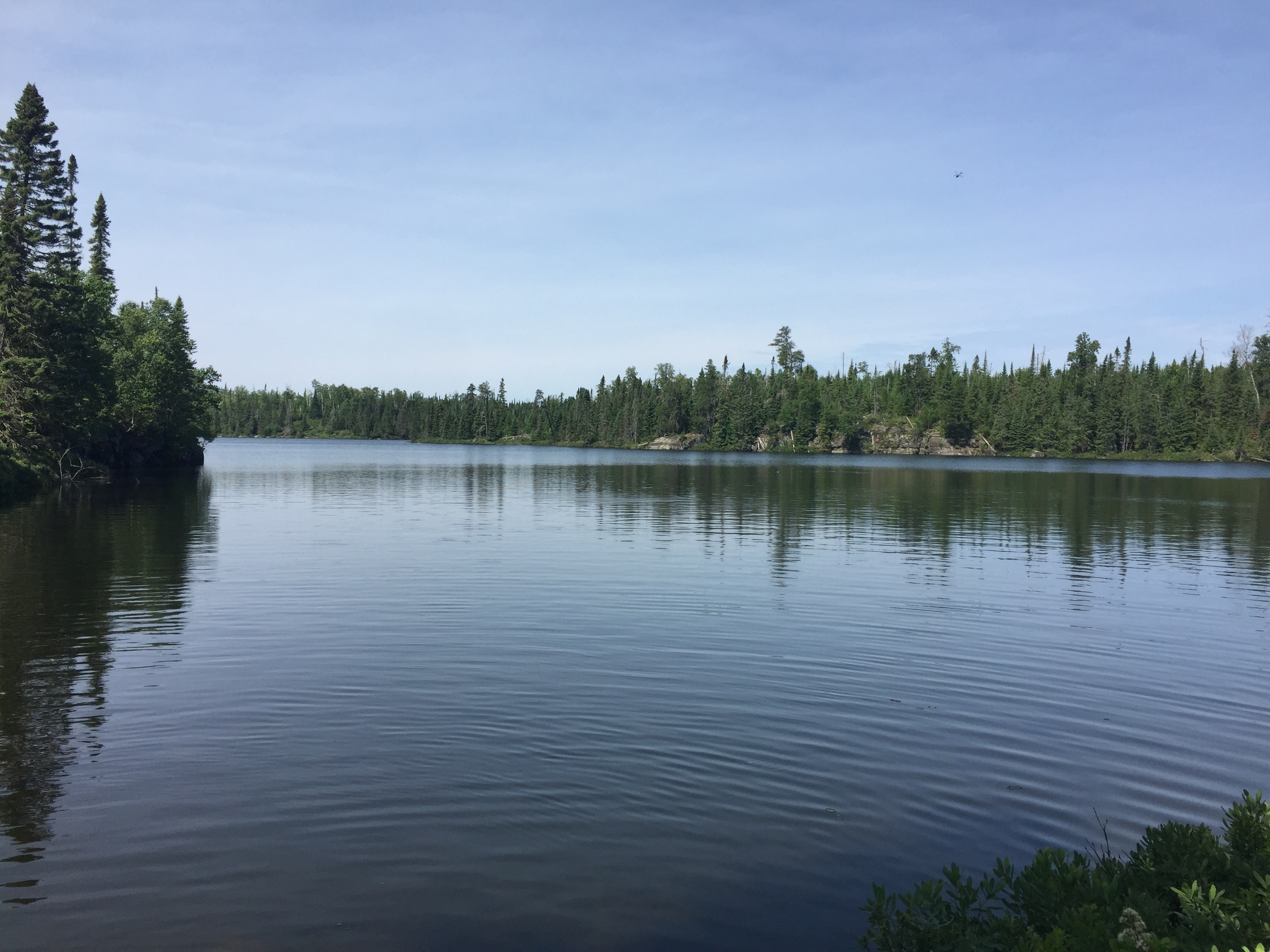
A view to the south/southeast from the northwest bay of Missing Link Lake. You are standing at the beginning of the portage to Round Lake. The portage is downhill to Round Lake in this direction. This is October in the BWCA. Portage to Round Lake -or- Explore Another Route **********************************************END OF ROUTE***********************************************
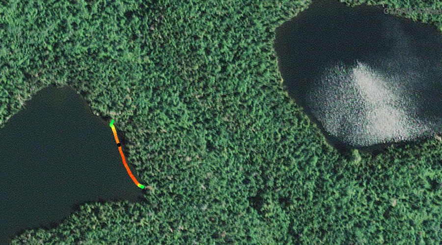
PADDLING FROM THE ROUND LAKE PORTAGE TO THE CAMPSITE ON THE NORTH SHORE
A view to the south/southeast from the northwest bay of Missing Link Lake. You are standing at the beginning of the portage to Round Lake. This is July in the BWCA (contrast with similar photo on this page that was taken in the fall).
This short paddle is from the Round Lake portage to the campsite just down the shore to the east. This is the campsite on the north shore of Missing Link Lake.
Campsite just east of the Round Lake portage on the north shoreline. Visit this Campsite -or- Explore Another Route **********************************************END OF ROUTE***********************************************
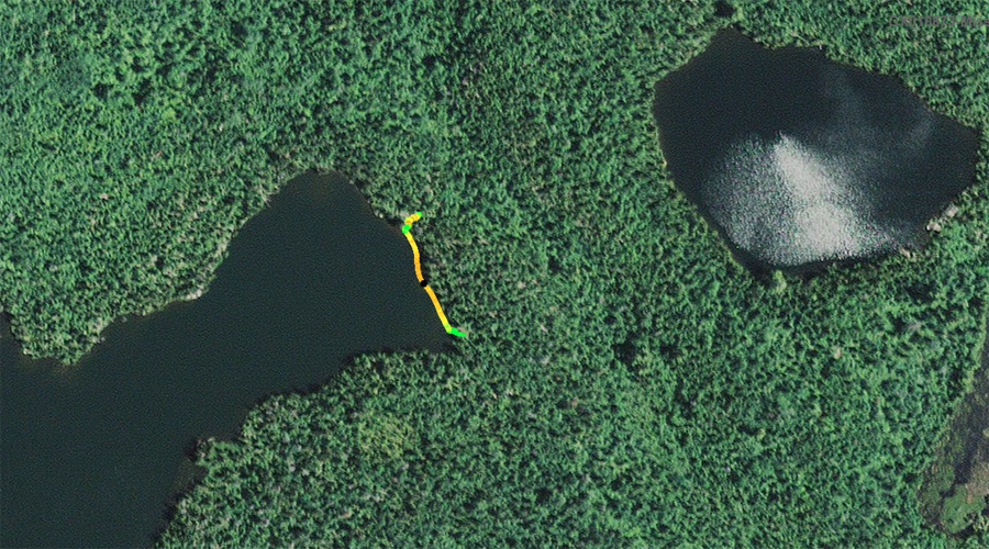
PADDLING FROM THE CAMPSITE ON THE NORTH SHORE TO THE SNIPE LAKE PORTAGE
View toward the south of the lakes prominent southwest point. This is also the location of one of the campsites on the lake.
Heading out from the campsite on the north shore of Missing Link Lake, paddle east until you reach the Snipe Lake portage.
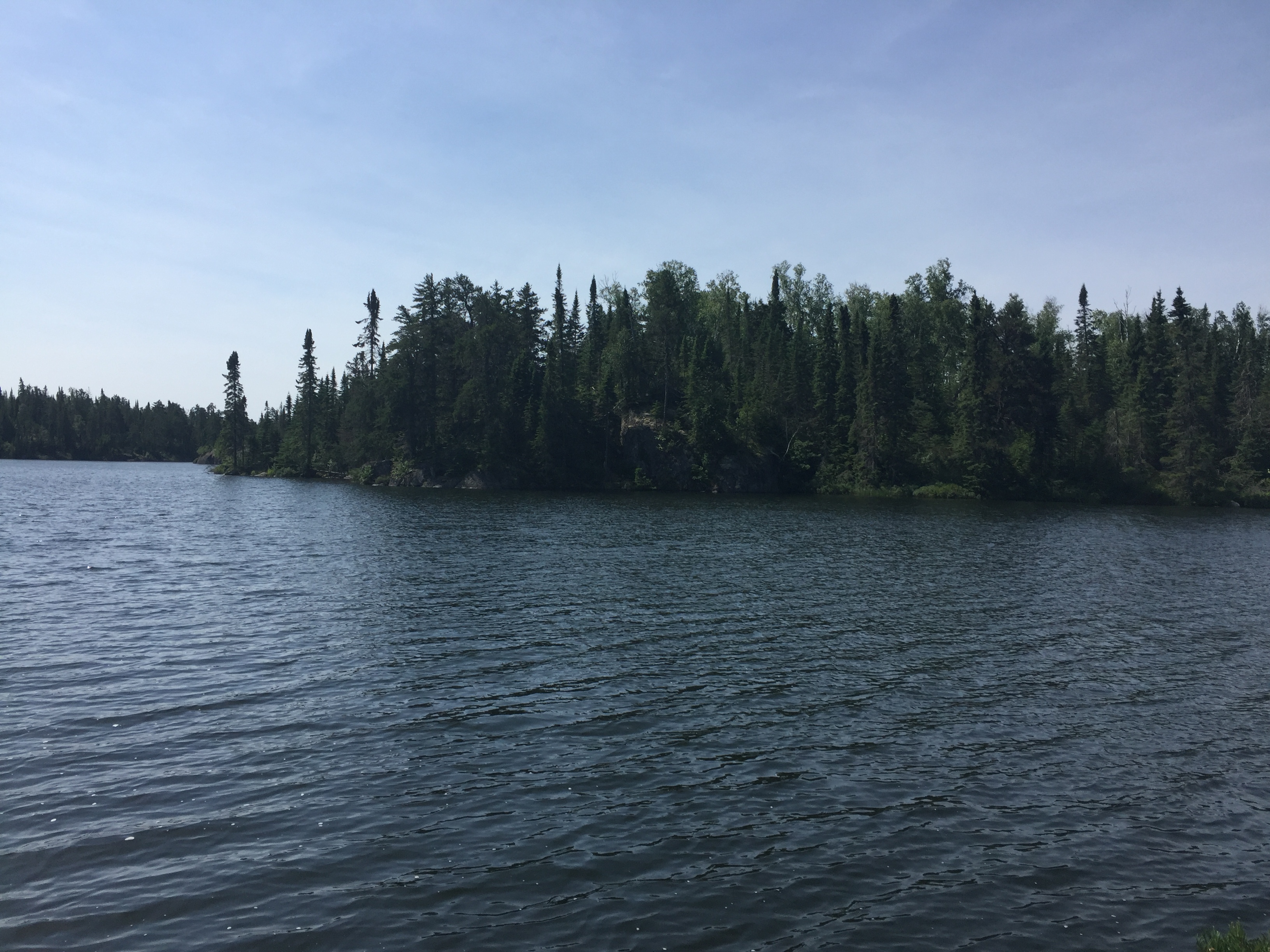
Looking toward the east shore of the north bay of Missing Link Lake. The Snipe Lake portage is found somewhere along that far shoreline (probably just a bit right of center).
View of Missing Link Lake from the Snipe Lake portage. This is not the location of the portage to Mavis Lake. The portage (really a faint and rugged trail) is to your left several hundred feet down the shoreline as you face the Snipe Lake portage canoe landing. Portage to Snipe Lake -or- Explore Another Route **********************************************END OF ROUTE***********************************************
PADDLING FROM THE ROUND LAKE PORTAGE TO THE SNIPE LAKE PORTAGE
Staying along the shoreline, head to the left from the Round Lake portage. You soon pass by the campsite on the north shore of Missing Link Lake. Continuing along the shore you arrive at the Snipe Lake portage. Portage to Snipe Lake -or- Explore Another Route **********************************************END OF ROUTE***********************************************
PADDLING FROM THE SNIPE LAKE PORTAGE TO THE TUSCARORA LAKE PORTAGE
Hugging the eastern shore of Missing Link Lake from the Snipe Lake portage to the Tuscarora Lake portage.
PADDLING FROM THE SNIPE LAKE PORTAGE TO THE MAVIS LAKE BUSHWHACK A quick paddle from the Snipe Lake portage to the start of the Mavis Lake bushwhack. This shows where to find the beginning of the Mavis Lake trail in relation to the Snipe Lake portage.